graphic-art, print, engraving
#
graphic-art
# print
#
islamic-art
#
engraving
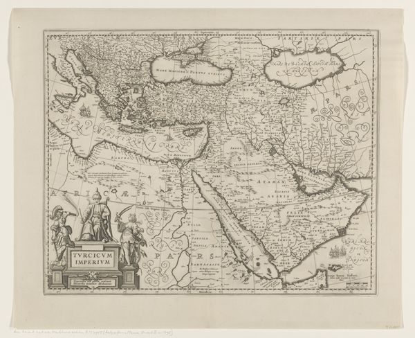
Dimensions: height 453 mm, width 555 mm
Copyright: Rijks Museum: Open Domain
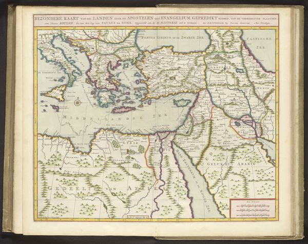
This is "Kaart van het Turkse Rijk," by Joannes L'Huilier, a map notable for its intricate detail and artistic presentation. The composition is carefully structured. The geographical accuracy serves as a framework for what is essentially a political statement. Notice how the neat lines defining territories and borders, along with the strategic placement of place names, function as signs of control and order. The light palette and soft rendering evoke a sense of enlightened observation, inviting viewers to see the Ottoman Empire as a defined entity. At the bottom left corner, human figures are placed on the map. Their inclusion reflects the cultural and political attitudes of the time. This juxtaposition suggests that geography is not merely about physical space but also about power dynamics and human narratives, as European figures gaze upon the Ottoman lands. The map is not just an objective depiction of land; it functions as a complex representation shaped by cultural perspectives, illustrating how cartography can reflect and reinforce particular views of the world.
Comments
No comments
Be the first to comment and join the conversation on the ultimate creative platform.
More like this