drawing, graphic-art, paper, ink
drawing
graphic-art
comic strip sketch
aged paper
light pencil work
baroque
sketch book
landscape
paper
personal sketchbook
ink
ink drawing experimentation
pen-ink sketch
sketchbook drawing
storyboard and sketchbook work
sketchbook art
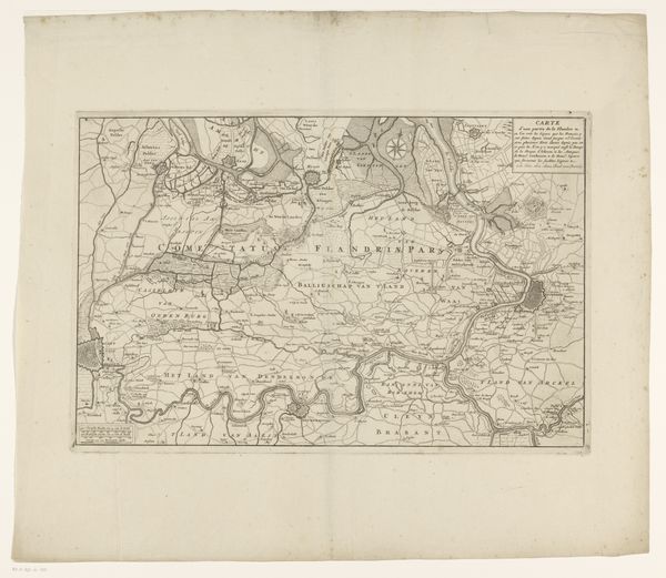
Dimensions: height 364 mm, width 445 mm
Copyright: Rijks Museum: Open Domain
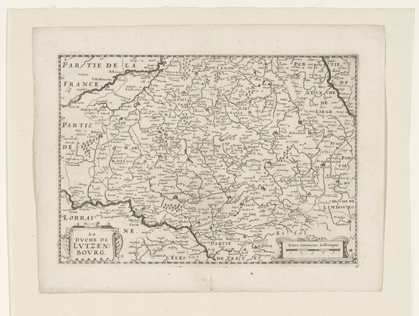
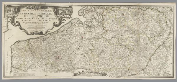
Ernst Ludwig Creite created this map of the Waasland, a region historically located between Flanders and the Scheldt River. Cartography has long been associated with power and control. This map, in its intricate detail, served not only as a tool for navigation but also as a representation of ownership and authority over the land and its people. Maps like these were instrumental in shaping political boundaries, facilitating trade, and asserting dominance. It’s worth considering the emotional experience for those whose lands and lives were being mapped. For the colonizer, a map can represent opportunity and power. But for the colonized, it can symbolize a loss of autonomy and a disruption of their relationship with the land. This map, beyond its practical use, is a cultural artifact that reflects the complex interplay between identity, power, and place. It invites us to consider the multiple narratives embedded in the seemingly objective representation of a region.
Comments
No comments
Be the first to comment and join the conversation on the ultimate creative platform.