painting
#
water colours
#
dutch-golden-age
#
painting
#
landscape
#
genre-painting
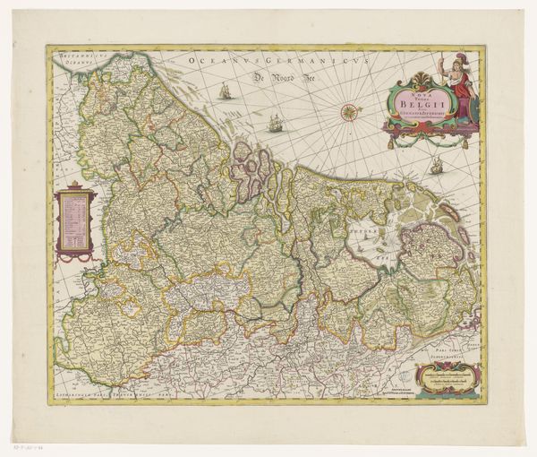
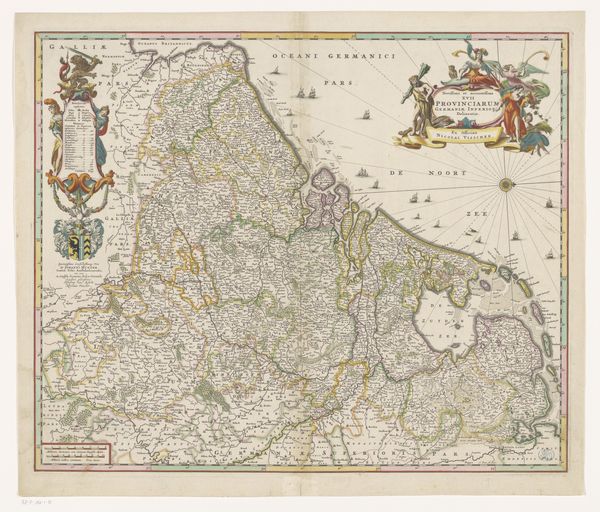
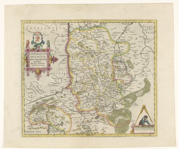
Dimensions: height 433 mm, width 544 mm
Copyright: Rijks Museum: Open Domain
Curator: This detailed 1659 map, titled "Kaart van de Zeventien Provinciën," offers a fascinating snapshot of the Seventeen Provinces of the Netherlands. Its delicate use of watercolors to delineate political boundaries catches the eye. Editor: Immediately striking. It's dense, crammed with detail, but the muted palette keeps it from feeling chaotic. You can almost smell the paper. Curator: The cartography itself provides clues to understanding Dutch society in the Golden Age. Mapmaking was a strategic undertaking. Editor: Definitely, and think of the labor invested. The production process, the inks and pigments, the paper itself— all would've been valuable commodities. Watercolors meant a certain accessibility, but a map like this also shows specialized skill, commerce and the growth of craft during the time. Curator: Exactly. These maps weren't purely for navigation. They were powerful visual representations, symbols of Dutch commercial dominance and expanding global reach. And a reminder of constantly shifting territories and political powers. Editor: So, each flourish isn't just decoration. What do you think is implied by Neptune, or one of his Roman counterparts, in the upper right? That section overall looks interesting. Curator: Neptune’s appearance is a declaration of maritime prowess and divine sanction over their voyages, so their claims over the sea! Think of these figures almost as a brand statement of the era. Editor: The precision is compelling when viewed through that lens, considering also the social context of its making. So much meticulous labour concentrated into representing power and, quite literally, owning the means to claim space through cartography. Curator: Absolutely. We get a glimpse into the 17th century Dutch aspiration. Editor: It makes one think differently about what is usually considered a somewhat ordinary item.
Comments
No comments
Be the first to comment and join the conversation on the ultimate creative platform.
More like this