drawing, print, paper, ink, engraving
#
drawing
#
baroque
# print
#
landscape
#
paper
#
ink
#
geometric
#
cityscape
#
engraving
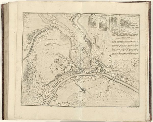
Dimensions: height 446 mm, width 570 mm
Copyright: Rijks Museum: Open Domain
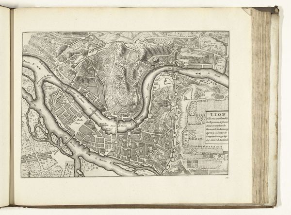
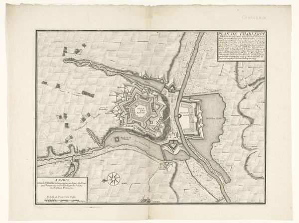
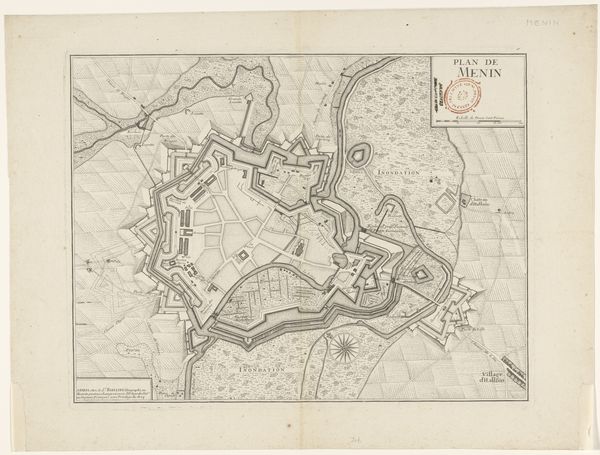
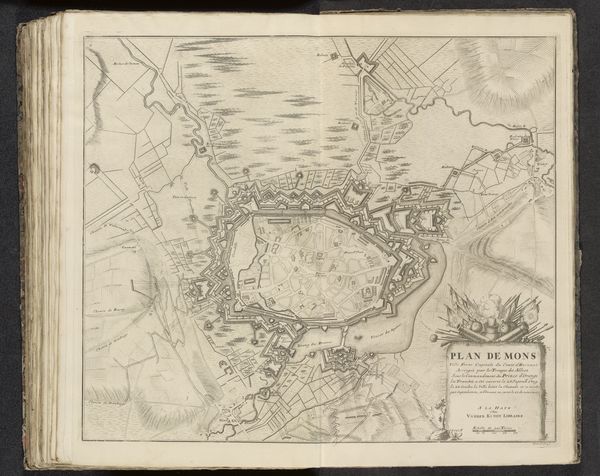
Editor: We’re looking at “Plattegrond van Namen, 1709” by Jacobus Harrewijn, a drawing and engraving in ink on paper held at the Rijksmuseum. It’s a detailed map, and what strikes me is how much labor went into creating it. What stands out to you? Curator: What interests me is understanding how a detailed print like this embodies the sociopolitical structures of its time. This wasn't just about geographical accuracy. Who commissioned it, and for what purpose? Maps like this, finely rendered through the craft of engraving, often served military or administrative needs. Editor: So, it’s less about the artistry and more about the function it served? Curator: Not entirely. Consider the materials themselves: ink, paper, engraving tools. The accessibility and cost of these materials would dictate who could commission and create such a piece. How does the act of its creation – the labor, skill, and resources involved – reflect the social hierarchies of the early 18th century? Were these cartographers highly valued artisans or simply laborers fulfilling a political need? Editor: That's a good point. I hadn’t considered the socioeconomic implications of producing something like this. It makes me think about the accessibility of information then compared to now. Curator: Exactly! The controlled dissemination of this knowledge through such prints solidified power structures. Think about the networks involved in production and distribution. Who profited? Who was excluded? How does this map become a material record of power? Editor: This really shifts my perspective. I’ll definitely look at other works with a more material-focused lens now. Curator: Understanding art through its materiality opens up broader narratives about society, labor, and the systems that enable artistic production. It challenges us to see art as more than just aesthetics.
Comments
No comments
Be the first to comment and join the conversation on the ultimate creative platform.
More like this