About this artwork
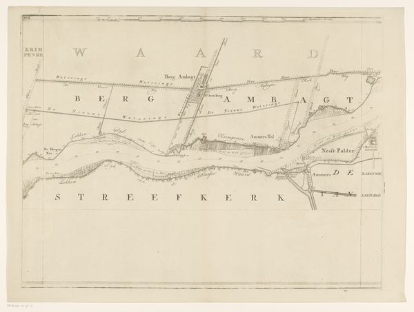
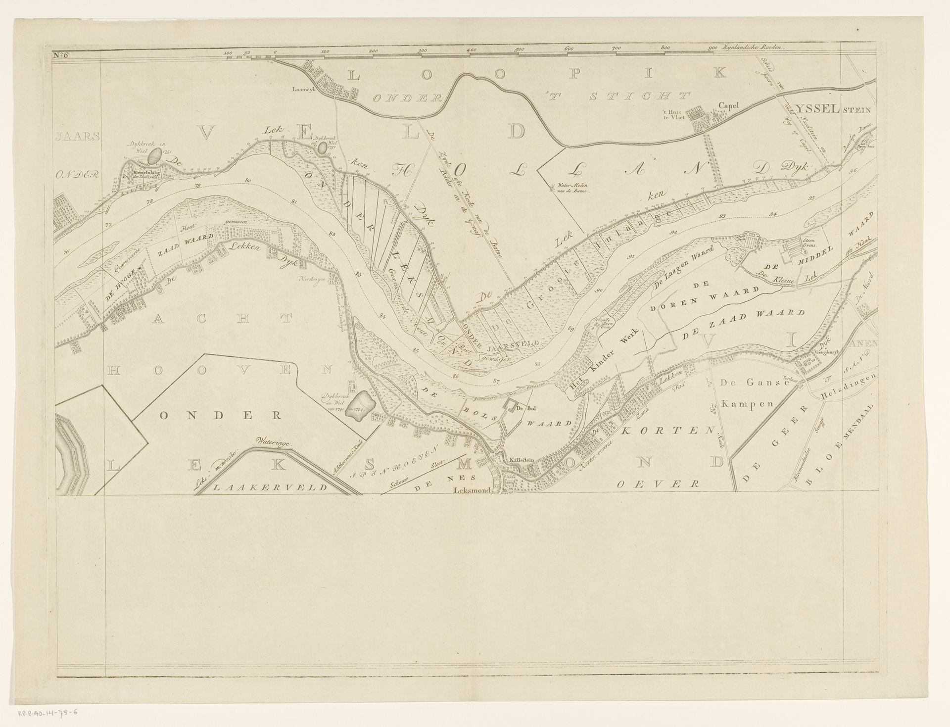
Isaak Tirion's map of the Lek River, created in the 18th century, presents a detailed landscape of waterways and settlements. But it is more than just a geographical record. It reflects a deeper, psychological relationship between humans and their environment. Notice how the river dominates the composition, its winding course a visual metaphor for the unpredictable flow of life and time. Water, in its myriad forms, has always been a potent symbol—of purification, renewal, and the subconscious. From ancient Mesopotamian myths to Renaissance allegories, rivers symbolize the ever-changing nature of existence. Consider the settlements along the riverbanks. These represent humanity's attempts to impose order on the natural world, to create safe harbors in the face of life's turbulent currents. The act of mapping itself is a psychological endeavor, an attempt to understand and control our surroundings. This drive to chart and navigate is a recurring motif in human history, echoing our deepest desires to find our place in the world.
Kaart van de rivier de Lek (zesde deel)
1764 - 1765
Isaak Tirion
1705 - 1765Location
RijksmuseumArtwork details
- Dimensions
- height 500 mm, width 661 mm
- Location
- Rijksmuseum
- Copyright
- Rijks Museum: Open Domain
Comments
Share your thoughts
About this artwork
Isaak Tirion's map of the Lek River, created in the 18th century, presents a detailed landscape of waterways and settlements. But it is more than just a geographical record. It reflects a deeper, psychological relationship between humans and their environment. Notice how the river dominates the composition, its winding course a visual metaphor for the unpredictable flow of life and time. Water, in its myriad forms, has always been a potent symbol—of purification, renewal, and the subconscious. From ancient Mesopotamian myths to Renaissance allegories, rivers symbolize the ever-changing nature of existence. Consider the settlements along the riverbanks. These represent humanity's attempts to impose order on the natural world, to create safe harbors in the face of life's turbulent currents. The act of mapping itself is a psychological endeavor, an attempt to understand and control our surroundings. This drive to chart and navigate is a recurring motif in human history, echoing our deepest desires to find our place in the world.
Comments
Share your thoughts