drawing, print, ink, engraving
#
drawing
#
baroque
# print
#
landscape
#
ink
#
geometric
#
cityscape
#
engraving
Dimensions: height 209 mm, width 274 mm
Copyright: Rijks Museum: Open Domain
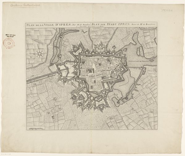
Jacobus Harrewijn created this detailed etching of the city of Ieper in 1709. At the turn of the 18th century, Ieper was a strategically significant city in the Austrian Netherlands, a region contested between European powers. Harrewijn’s plan offers insights into the era's military strategies and urban planning. The star-shaped fortifications around Ieper were designed to maximize defensive capabilities, reflecting the constant threat of invasion and siege. Such fortifications also influenced the social structure of the city, determining movement and access. The orderly layout of streets and buildings within the fortifications speaks to the imposition of control over urban space, impacting the daily lives of Ieper’s inhabitants. This detailed rendering also obscures the social realities of the time: the disparities in living conditions, the segregation of communities, and the economic activities that fueled the city. As you consider this map, reflect on how power shapes the spaces we inhabit.
Comments
No comments
Be the first to comment and join the conversation on the ultimate creative platform.
More like this