drawing, print, ink, pen, engraving
#
drawing
#
medieval
# print
#
pen sketch
#
old engraving style
#
ink
#
pen-ink sketch
#
pen work
#
pen
#
cityscape
#
engraving
Dimensions: height 415 mm, width 509 mm
Copyright: Rijks Museum: Open Domain
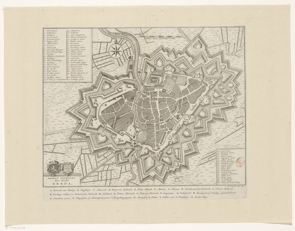
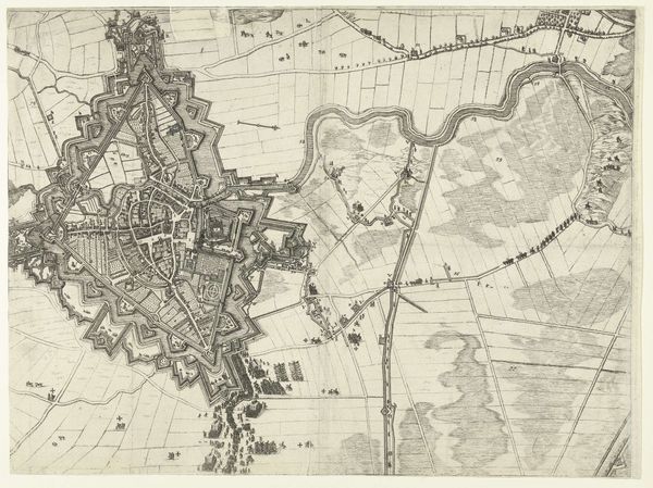
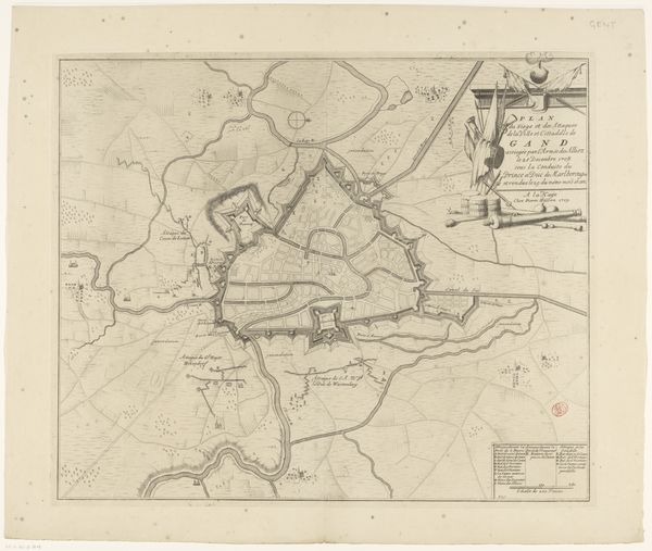
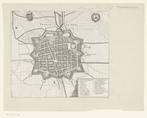
Curator: Here we have an intriguing piece, "Vestingplattegrond van Sint-Winoksbergen," created anonymously sometime between 1690 and 1744. It’s a detailed plan of a fortified city, rendered in pen, ink, and engraving. Editor: My immediate impression is one of controlled chaos. The rigid geometric patterns of the fortifications contrast with the organic, almost scribbled textures used to represent the landscape. Curator: Precisely. Notice the line work. The tight, precise strokes used to delineate the city walls, roads, and buildings speak to a deliberate intent to create a scientifically accurate representation. The formal composition places the city as a symbolic order against a world not under human control. Editor: I'm struck by the sheer labor involved. Imagine the repetitive movements required to create such dense and precise engravings. The anonymous nature of the artist further highlights the idea of a skilled laborer employed to serve a strategic function, where personal expression is secondary. Was this part of some military campaign? Curator: Very likely. These city plans were valuable tools for military strategists and political leaders. Beyond their functional aspect, though, they serve as aesthetic objects of study—witness to the rationalization and visual ordering of space. Look closely at the circular pattern dominating the city core: a direct trace to the philosophical ideals of this epoch, reflected even at the level of planning and architectural endeavors. Editor: Thinking about material scarcity, what dictated the artist’s choices? Was paper consistently available, or was it rationed? What quality of ink was used and how might those pigments degrade? Did that impact mark-making and, therefore, the map's detail? Curator: Such questions enrich our understanding. The artist’s restricted palette is inherent to the materials available, guiding how symbolic order, and the need for spatial clarity, are achieved within defined technological parameters. These limited elements allow us to assess how the visual design itself conveyed the strength and power of the city's infrastructure, both in strategic and ideological terms. Editor: The artist’s choice of the print medium allows for wide distribution of knowledge, turning cartography into a commodity for those with a need to plan their next movements, military and otherwise. Interesting how practical the intention can be. Curator: Indeed. By uniting our formalist reading of geometric rigor and symbolic intention with your insights into material constraints and strategic distribution, we arrive at a fuller appreciation of this anonymous map-maker's work. Editor: A perfect intersection.
Comments
No comments
Be the first to comment and join the conversation on the ultimate creative platform.
More like this