drawing, print, ink, engraving
#
drawing
#
baroque
#
dutch-golden-age
# print
#
landscape
#
ink
#
geometric
#
engraving
Dimensions: height 376 mm, width 462 mm
Copyright: Rijks Museum: Open Domain
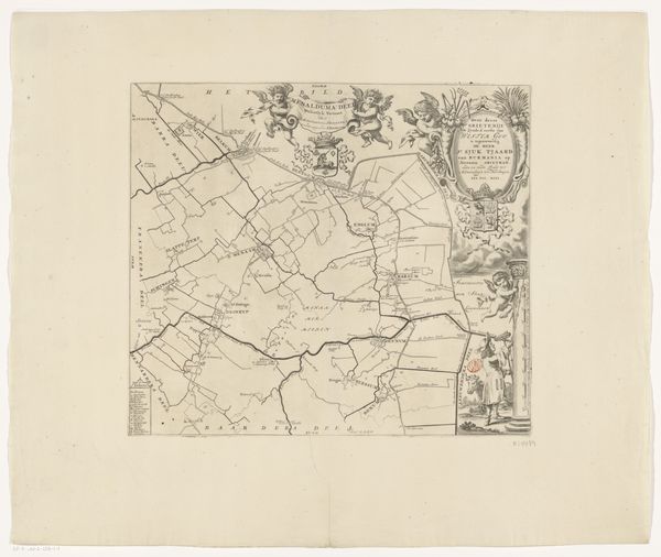
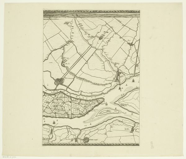
Curator: So, we’re looking at an early 18th-century map titled "Kaart van de grietenij Dantumadeel," believed to be from around 1698-1718, created by an anonymous hand. It’s a detailed drawing, or rather, a print, really – an engraving in ink. What’s your first take on it? Editor: I get a sense of serenity, almost dreamlike despite its precision. It feels like peering into a still moment in time. It reminds me of old stories found in attic chests, full of secrets only whispers can reveal. Curator: The piece uses landscape conventions typical of Dutch Golden Age mapping but merges that with a decorative, almost baroque flourish. The way the land is articulated and the fine, detailed lines suggest not just territory, but an aesthetic object, too. What catches your eye structurally? Editor: The rigid geometric divisions, counterpointed by these freeform meandering lines where water is represented. It gives me such a conflicting sensation of structure versus nature. Do you think it reflects how these societies thought about managing land? Curator: Exactly! You see these formalized lines as these controlling mechanisms carving up the world. The dark ink communicates power, as well. Also, notice the contrast in how settlements versus natural features are rendered, maybe highlighting their relationship and how humans existed in this space. It shows you the negotiation between culture and landscape, what a place might offer if respected, and, conversely, if abused. Editor: Abuse, right. It’s haunting actually, how that control imposed is the destruction of something. Curator: Yes! What strikes me most is how this simple map serves as a mirror. Even a few hundred years later, we keep drawing, keep defining ourselves on landscapes whether it’s virtual or real. It seems less like ink on parchment and more like ink under my skin somehow. Editor: I leave it behind with a renewed sensitivity, like I understand better our deep connection with space. Maybe we could use some more time sitting in silence. Curator: Precisely, this silent cartography tells its untold narratives for us to witness. Thank you for your reflection.
Comments
No comments
Be the first to comment and join the conversation on the ultimate creative platform.
More like this