About this artwork
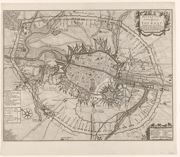
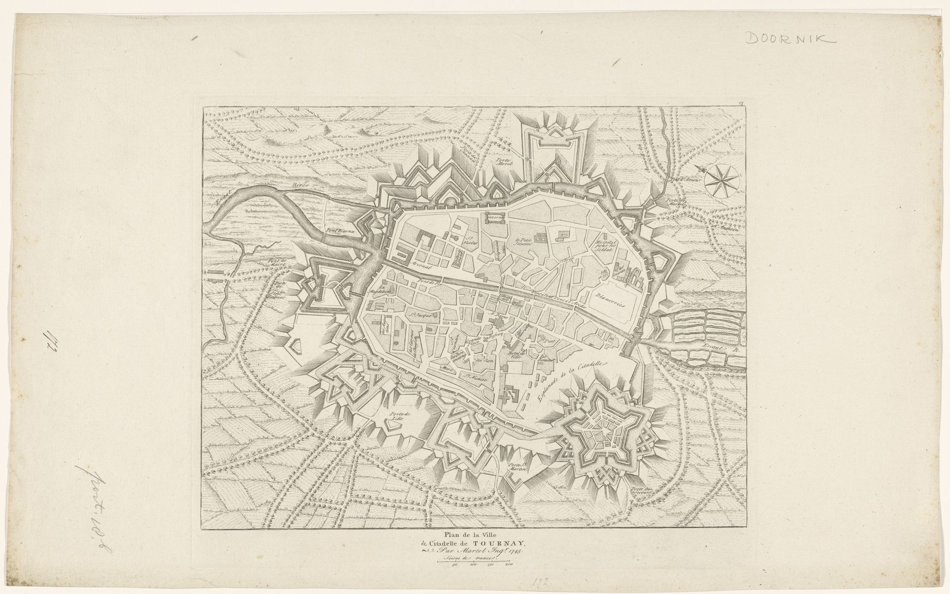
This is an anonymous plan of the city of Doornik, made with pen and gray ink. Maps like this were tools of power, reflecting a time when control over territory meant everything. They embody the intersection of political ambition and cultural identity. The detailed fortifications surrounding the city aren't just about military strategy, they speak volumes about the constant threat of invasion and the collective anxiety of its inhabitants. This city map served not only practical purposes but also helped to create a sense of place and shared identity. In a world where personal and communal safety was never guaranteed, these fortified cities represented the height of security. The emotional weight of this piece lies in understanding how people’s lives were shaped by these physical boundaries, and how those boundaries defined who they were. Consider how this historical map shapes our understanding of place, power, and identity today.
Artwork details
- Medium
- print, ink, engraving
- Dimensions
- height 288 mm, width 344 mm
- Copyright
- Rijks Museum: Open Domain
Tags
Comments
Share your thoughts
About this artwork
This is an anonymous plan of the city of Doornik, made with pen and gray ink. Maps like this were tools of power, reflecting a time when control over territory meant everything. They embody the intersection of political ambition and cultural identity. The detailed fortifications surrounding the city aren't just about military strategy, they speak volumes about the constant threat of invasion and the collective anxiety of its inhabitants. This city map served not only practical purposes but also helped to create a sense of place and shared identity. In a world where personal and communal safety was never guaranteed, these fortified cities represented the height of security. The emotional weight of this piece lies in understanding how people’s lives were shaped by these physical boundaries, and how those boundaries defined who they were. Consider how this historical map shapes our understanding of place, power, and identity today.
Comments
Share your thoughts