drawing, print, paper, ink, engraving
drawing
baroque
paper
ink
geometric
cityscape
history-painting
engraving
Dimensions: height 210 mm, width 273 mm
Copyright: Rijks Museum: Open Domain
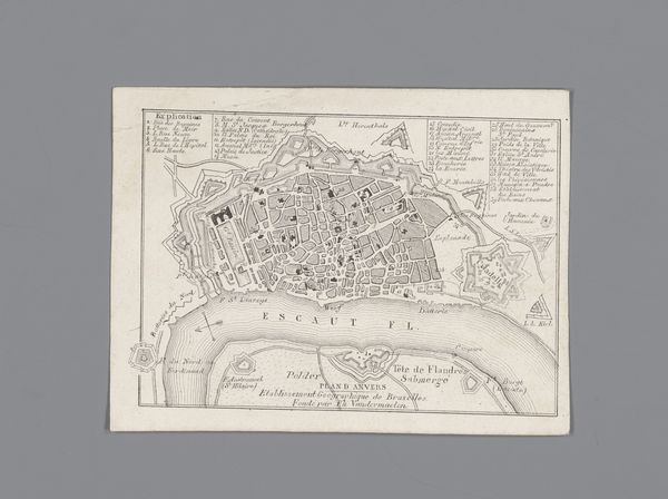
Jacobus Harrewijn created this detailed map of Ieper in 1709, using ink on paper. At first glance, the intricate network of lines and shapes captures the eye, presenting a city meticulously planned and fortified. The light and shadow play, achieved through the density of lines, gives depth to the two-dimensional surface. The map’s structure reveals a fascinating interplay between geometric precision and organic adaptation. Fortification walls form a structured, almost mathematical pattern, sharply contrasting with the irregular layout of the urban space they enclose. This juxtaposition can be interpreted through the lens of structuralism, highlighting how opposing elements—order and chaos, nature and artifice—define the city’s identity. The stark lines delineate not just geographical boundaries but also systems of power and control, suggesting a society organized by strict rules. Ultimately, the map destabilizes a fixed notion of urban space. It is a formal representation, open to endless interpretations about the intersection of planning, power, and the lived experience of the city.
Comments
No comments
Be the first to comment and join the conversation on the ultimate creative platform.