About this artwork
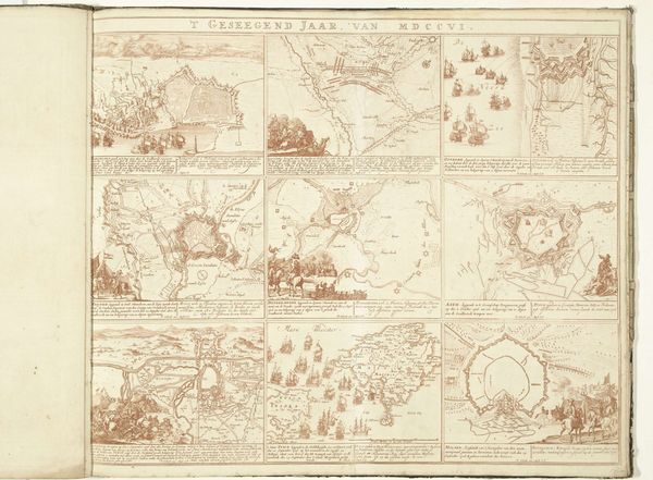
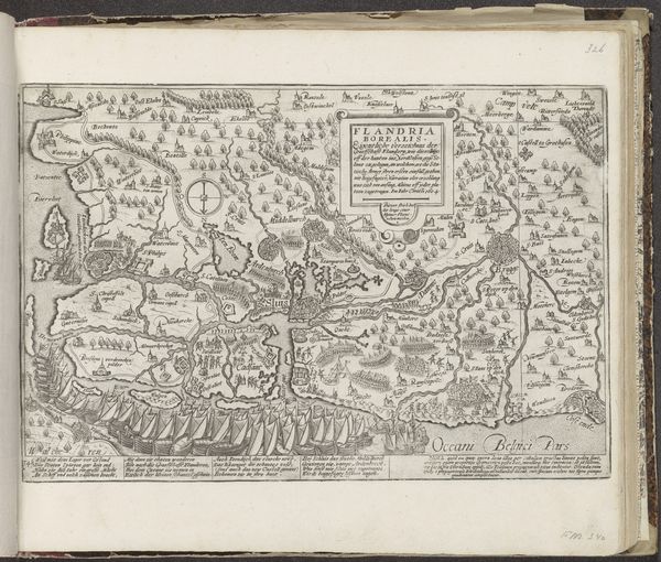
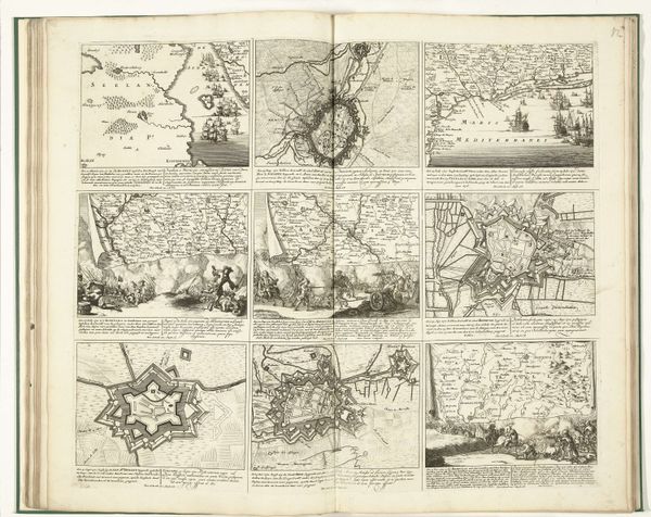
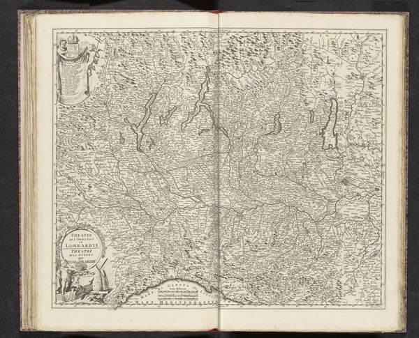
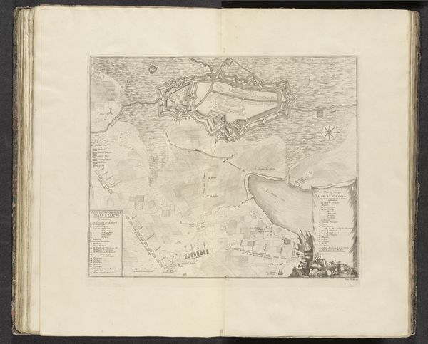
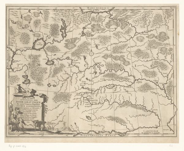
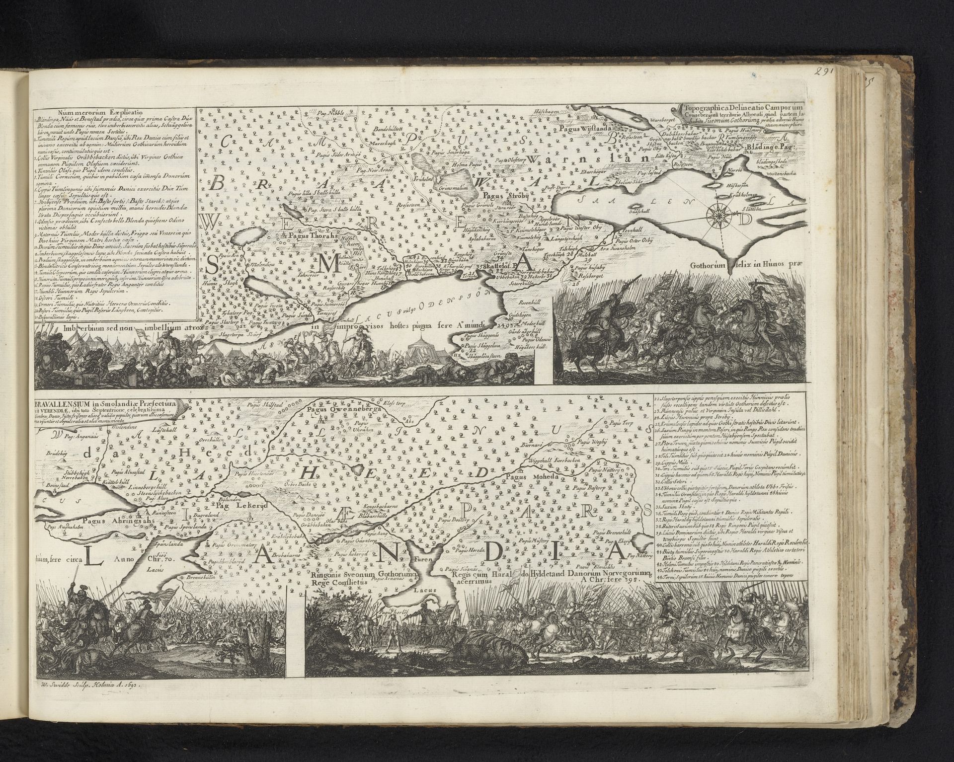
Willem Swidde created this map of the Bravalla Heath as an engraving. Maps are often seen as objective records, but they also reflect the cultural values and power structures of their time. In the 17th-century Dutch Republic, mapmaking was a booming industry fueled by trade, exploration, and military expansion. Swidde’s map isn't just a neutral depiction of land, but a statement about the Dutch relationship to territory and power. Notice the troop movements illustrated in the map's vignettes, and the extensive key. These could represent the assertion of military control, or perhaps the projection of Dutch power onto this landscape. To fully understand this image, we would need to delve into archives about the Dutch military history and the period's cultural understanding of landscape. The map becomes a fascinating site where art, science, and politics intersect.
Artwork details
- Medium
- print, engraving
- Dimensions
- height 293 mm, width 379 mm
- Location
- Rijksmuseum
- Copyright
- Rijks Museum: Open Domain
Tags
Comments
Share your thoughts
About this artwork
Willem Swidde created this map of the Bravalla Heath as an engraving. Maps are often seen as objective records, but they also reflect the cultural values and power structures of their time. In the 17th-century Dutch Republic, mapmaking was a booming industry fueled by trade, exploration, and military expansion. Swidde’s map isn't just a neutral depiction of land, but a statement about the Dutch relationship to territory and power. Notice the troop movements illustrated in the map's vignettes, and the extensive key. These could represent the assertion of military control, or perhaps the projection of Dutch power onto this landscape. To fully understand this image, we would need to delve into archives about the Dutch military history and the period's cultural understanding of landscape. The map becomes a fascinating site where art, science, and politics intersect.
Comments
Share your thoughts