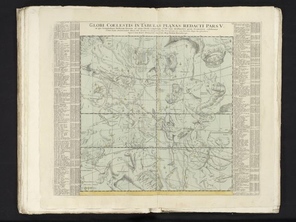
Eerste deel van een zesdelige reeks kaarten van de sterrenhemel aan het eind van het jaar 1730 1742
0:00
0:00
anonymous
Rijksmuseum
drawing, print, paper, engraving
#
drawing
# print
#
landscape
#
paper
#
geometric
#
history-painting
#
engraving
#
rococo
Dimensions: height 498 mm, width 584 mm
Copyright: Rijks Museum: Open Domain
This celestial map, the first of six parts and made around 1730 by an anonymous artist, presents a fascinating interplay between science and art. The circular composition, centered on the Arctic constellations, immediately draws the eye into a world where stars and mythical creatures intertwine. The constellations are rendered in delicate lines and muted tones of green and grey, giving them an ethereal quality. The quadrants and tables of text bordering each side, create a balanced yet complex structure. This structure is not merely decorative; it reflects a desire to impose order on the cosmos, categorizing and mapping the stars in a rational system. However, the inclusion of mythological figures disrupts this order. These figures act as signs, encoding cultural narratives within the scientific framework of the map. The map thus engages with a kind of semiotic tension, destabilizing any fixed meaning. Consider how the precise engraving contrasts with the speculative nature of the constellations. It is this tension between empirical observation and imaginative interpretation that makes the map so compelling. Its meaning continues to evolve as we view it through different historical and cultural lenses.
Comments
No comments
Be the first to comment and join the conversation on the ultimate creative platform.
More like this