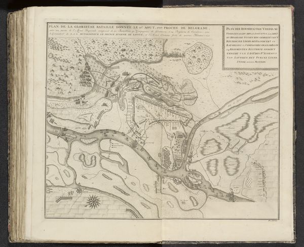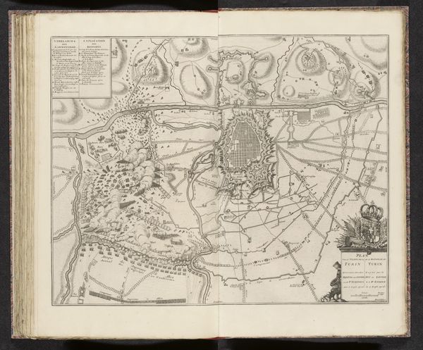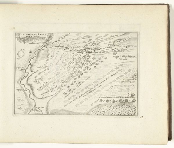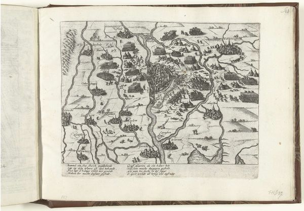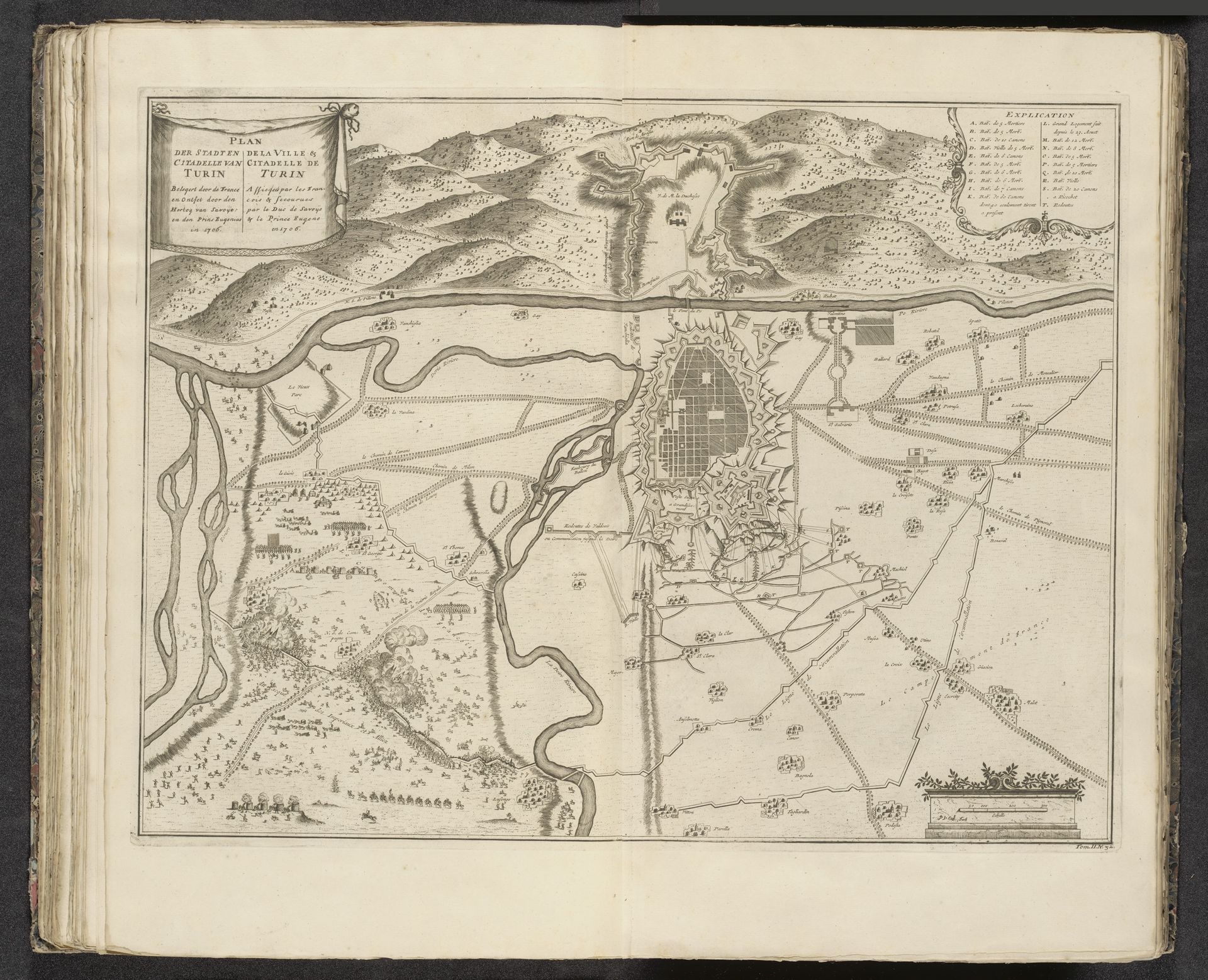
1706 - 1729
Beleg en ontzet van Turijn, 1706
Pieter van (II) Call
1688 - 1737Location
RijksmuseumListen to curator's interpretation
Curatorial notes
Curator: Here we have a fascinating print from the early 18th century titled, "Beleg en ontzet van Turijn, 1706," which translates to "Siege and Relief of Turin, 1706." It was crafted sometime between 1706 and 1729 by Pieter van Call the Younger. Editor: My goodness, what a marvel of detail! The fineness of the lines gives it a certain shimmering quality, doesn't it? I can almost feel the intensity, the focused concentration needed to create such a complex image of Turin, like a snapshot from above, full of military implications... Curator: Absolutely! The work depicts Turin during a crucial historical moment: the siege during the War of the Spanish Succession. It's an incredible example of how prints were used as historical records and propaganda. The printmaker precisely lays out all the actors around Turin and explains their role through a descriptive caption on the upper-right corner of the work. Editor: It’s the tension between art and documentation that really grabs me. Each tiny line, so deliberately placed. Can you imagine trying to comprehend it as someone experiencing the events depicted? Trying to trace friends’ houses within those lines as smoke and cannon fire are filling the air! It has that almost godlike quality, knowing something’s totality. Curator: Precisely! Prints like these were critical in shaping public opinion and disseminating information during times of conflict. Van Call’s strategic employment of the Baroque aesthetic transforms a map of military activity into a spectacle for cultural discussion in intellectual circles. The museum or the court could share strategic plans through allegory to key members, who would understand that “to learn to see is to acquire power.” Editor: A powerful act of storytelling in this detailed visual summary. Thinking of all that intricate handiwork makes me wish I knew who were the artisans that gave this feeling of immortality to the artwork! So much dedication distilled into lines...it’s quite magical, really. Curator: Indeed. Let’s hope it encourages a better reading of the intricacies of visual records. Editor: Let’s trust the next generations look closer!