drawing, paper, watercolor
#
drawing
#
landscape
#
paper
#
watercolor
Dimensions: height 665 mm, width 460 mm
Copyright: Rijks Museum: Open Domain
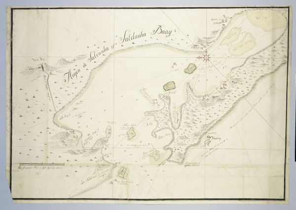
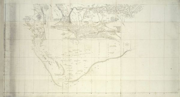
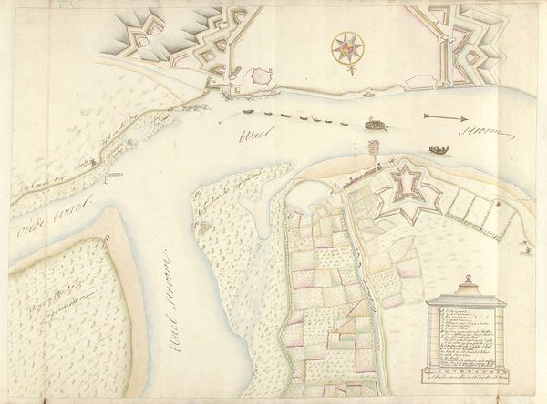
Robert Jacob Gordon produced this map of Hout Bay with pen, ink, and watercolour. Its muted palette and precise lines create a serene, almost abstract composition. The structure of the map directs our attention to its formal elements. Notice how the bay's shape is defined by a delicate line of pale yellow and green, a border that separates land from sea. Numbers peppered across the water denote depth, transforming the bay into a field of numerical data. This cartographic method flattens the space, reducing the complexity of the natural world to a series of calculated points. Consider how this formal approach reflects broader Enlightenment ideals. There is a desire to quantify and classify the world through empirical observation. Yet, the very act of mapping, of imposing a grid onto nature, reveals an attempt to control and rationalize the unknown. This tension between observation and control is central to understanding not only this map, but also the broader colonial project it served.
Comments
No comments
Be the first to comment and join the conversation on the ultimate creative platform.
More like this