drawing, paper, ink, pencil
#
drawing
#
landscape
#
paper
#
ink
#
pencil
#
pen and pencil
#
realism
Dimensions: height 1090 mm, width 760 mm
Copyright: Rijks Museum: Open Domain
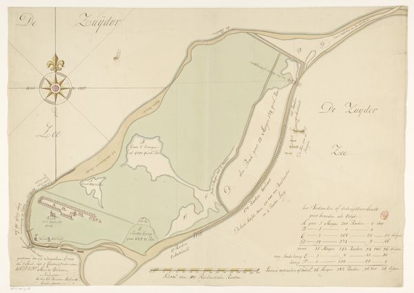
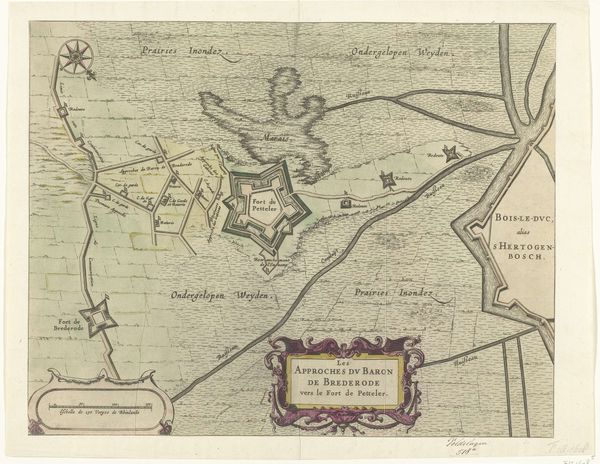
This is Robert Jacob Gordon's "Map of Saldanha Bay and immediate surroundings," created with pen, ink, and wash on paper. The map's formal structure reveals much about its intent. A muted palette emphasizes the detailed lines and shapes that define the bay's topography. The composition is carefully organized, balancing negative space with densely marked coastal features. The use of line, from delicate contours to bold labels, guides the viewer's eye. Gordon uses semiotic codes to convey information, such as depth and terrain. The map challenges our understanding of representation, highlighting the tension between objective observation and subjective interpretation. It's a functional document and an aesthetic object reflecting Enlightenment ideals of scientific accuracy, where the aesthetic and the functional are intertwined, each informing the other.
Comments
No comments
Be the first to comment and join the conversation on the ultimate creative platform.
More like this