print, engraving
# print
#
old engraving style
#
landscape
#
personal sketchbook
#
geometric
#
history-painting
#
early-renaissance
#
engraving
#
realism
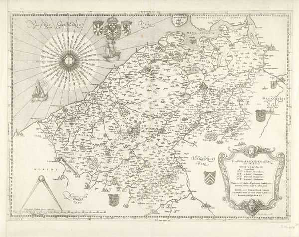
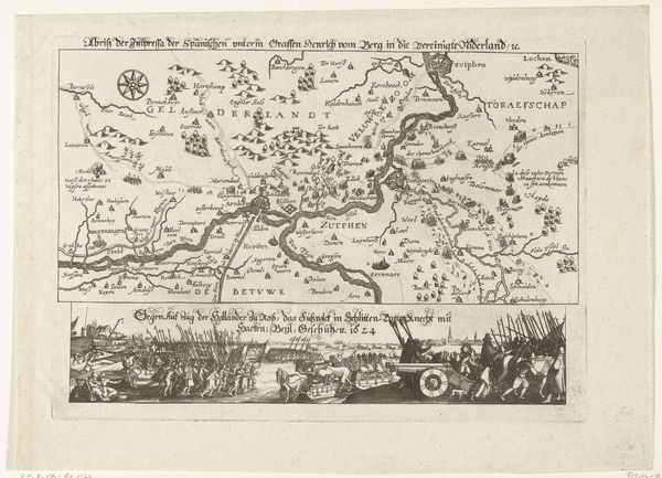
Dimensions: height 413 mm, width 490 mm
Copyright: Rijks Museum: Open Domain
Editor: This is “Kaart van Vlaanderen,” a 1559 engraving currently held at the Rijksmuseum. Looking at this map, I’m struck by how it tries to blend objective geographic data with these symbolic, almost heraldic images. It makes me wonder: what do you see in this piece? Curator: It’s fascinating how these early maps weren't just about accurate representation. They actively constructed a visual language that encoded power, identity, and a particular worldview. The "Kaart van Vlaanderen," wasn't just showing the land, but also staking a claim, visually articulating who belonged and who controlled that territory. How do you think the inclusion of those heraldic symbols contributed to this articulation of power? Editor: That’s interesting! So, they weren’t necessarily trying to be neutral? Maybe the choice of which towns to include, or even the way the coastlines are drawn, could also carry a kind of symbolic weight? Curator: Exactly. The map becomes a political stage. Think about the concept of 'cartographic violence,' where maps can be instruments of colonization and oppression, erasing indigenous presence or reinforcing colonial boundaries. How might this map, even in its relatively early form, foreshadow some of those later uses of cartography? Who has access to and the authority to create maps are also questions that comes to mind. Editor: It sounds like, far from being just an objective document, this map is participating in some heavy social and political dialogues. That’s made me look at it with a whole new perspective! I'd thought of it only as an archaic object, not as an agent itself. Curator: Right. By questioning what appears ‘objective,’ we can understand how power is embedded in visual culture. And in this case, how the mapping of space is the assertion of place and belonging.
Comments
No comments
Be the first to comment and join the conversation on the ultimate creative platform.
More like this