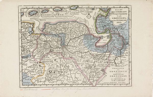
Kaart van de gebieden in Overijssel en Gelderland getroffen door de overstromingen in 1825 1825
0:00
0:00
anonymous
Rijksmuseum
print, etching
# print
#
etching
#
history-painting
#
regionalism
#
realism
Dimensions: height 176 mm, width 249 mm
Copyright: Rijks Museum: Open Domain
This is a map made in 1825 of the regions in Overijssel and Gelderland, recording the devastation wrought by flooding. Notice the compass rose: an emblem of navigation and orientation. It appears here as a poignant marker of lost direction, reflecting the disorientation and chaos that the floods would have caused. The compass, typically a symbol of control and understanding, is now a stark reminder of nature's overwhelming power and the precariousness of human endeavors. This symbol has a long history: from ancient mariners using it to chart the seas, to its more modern uses. The enduring symbol speaks to our attempts to understand and control our environment, yet also serves as a humbling reminder of the elemental forces that can undo our efforts, as seen in this map of destruction. It evokes a deep, subconscious recognition of our vulnerability. As we look at this map, let's contemplate the cyclical dance between humanity and nature: a progression of control, disruption, and adaptation, ever-present in our collective memory.
Comments
No comments
Be the first to comment and join the conversation on the ultimate creative platform.
More like this