print, etching, engraving
#
comic strip sketch
#
baroque
# print
#
pen sketch
#
etching
#
old engraving style
#
personal sketchbook
#
sketchwork
#
pen-ink sketch
#
pen work
#
sketchbook drawing
#
cityscape
#
history-painting
#
storyboard and sketchbook work
#
sketchbook art
#
engraving
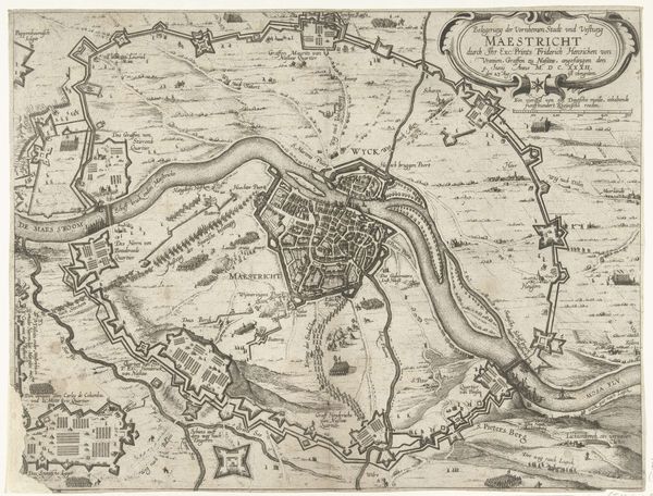
Dimensions: height 109 mm, width 137 mm
Copyright: Rijks Museum: Open Domain
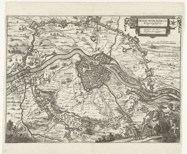
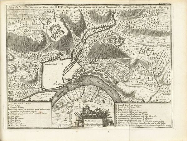
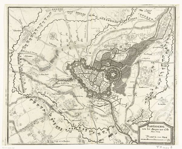
Bernard Picart created this print of the Siege of Maastricht in 1632, likely some years later, using etching. The map depicts Maastricht encircled by fortifications during the Dutch Republic's conflict with the Spanish. The highly detailed, technical rendering emphasizes the city's defenses, key to its strategic importance. Cartography like this wasn’t just about geography; it was about power and control. Maps were tools of governance, projecting authority and claiming territory. Produced in the Dutch Republic, this print reflects the cultural and political climate of a society deeply invested in trade, exploration, and military strategy. Institutions such as the military, and the market for printed images, drove the demand for such cartographic works. To understand this print fully, we can consult military records, period maps, and the archives of the Dutch Republic, piecing together the story of a city under siege and a nation defining its place in a turbulent world. The meaning of art is always contingent on its social and institutional context.
Comments
No comments
Be the first to comment and join the conversation on the ultimate creative platform.
More like this