print, engraving
#
baroque
# print
#
old engraving style
#
geometric
#
cityscape
#
engraving
Dimensions: height 240 mm, width 310 mm
Copyright: Rijks Museum: Open Domain
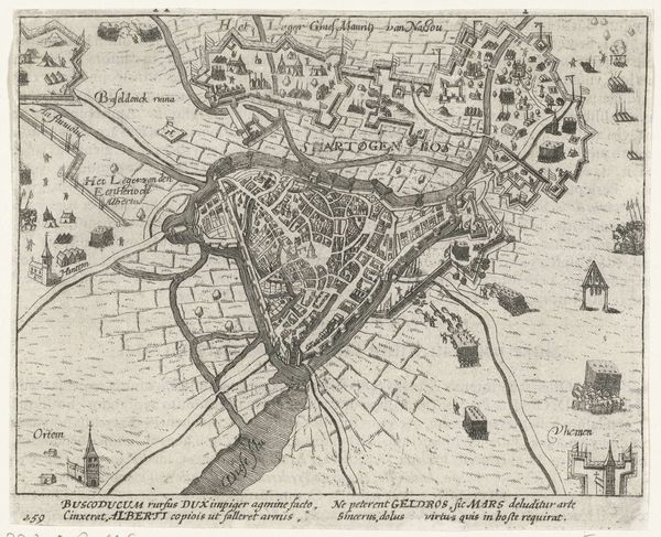
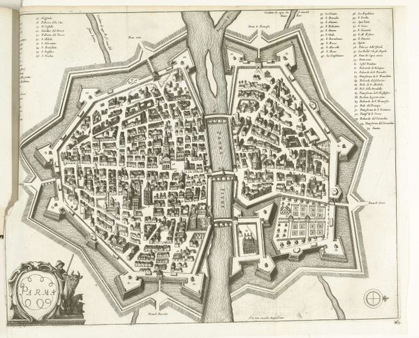
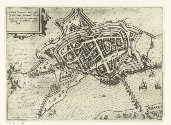
Editor: Here we have what's called "Plattegrond van Rome," dating back to around 1702. It's an engraving, so a print, by an anonymous artist. It's so detailed, but I'm immediately struck by how the river seems to bisect the whole composition. What are your thoughts on this work? Curator: The romance of old maps, right? I love thinking about someone, back then, poring over this, tracing routes, imagining themselves in Rome. Look at the detail – it’s like the whole city is exhaling onto the paper. What about the little trees? Do you think those are meant to be accurate or more symbolic, like puffs of breath suggesting a forest? Editor: Symbolic, maybe? I mean, they seem kind of uniformly spaced, less about true representation. And there are all these small labels, hard to read but hinting at the city's features. It's so meticulous. Did maps like this serve a specific purpose beyond just navigation? Curator: Oh, absolutely! They were status symbols, declarations of knowledge, power. To possess a map of Rome was to possess a piece of Rome itself. But look closer, does the rigidity of the layout make you wonder what it’s like to lose yourself in the messiness of actually getting around the place? Editor: That's a cool point. It's almost *too* organized, losing that human element, maybe? I didn't even consider the status angle! Curator: Maps have stories within stories. This one makes me feel like getting lost, but with a good map, of course! Editor: Right? Well, I'm definitely seeing more than just geography now. Thanks for opening up a new way of looking at old city maps!
Comments
No comments
Be the first to comment and join the conversation on the ultimate creative platform.
More like this