drawing, graphic-art, print, etching, engraving
#
drawing
#
graphic-art
#
dutch-golden-age
# print
#
etching
#
geometric
#
line
#
cityscape
#
engraving
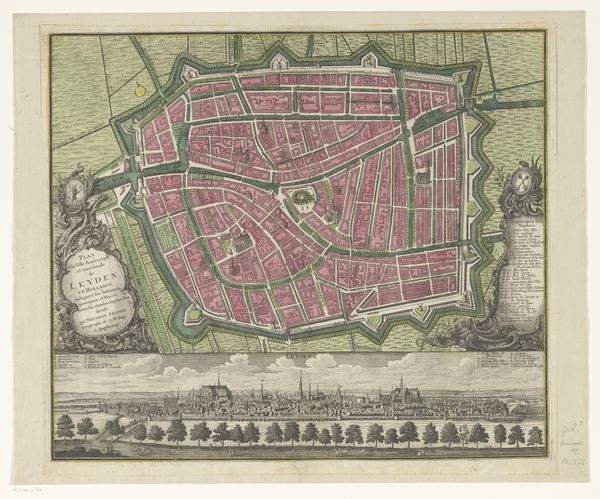
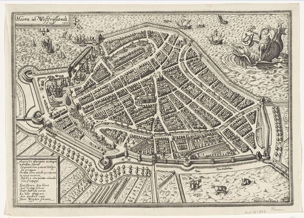
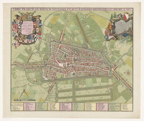
Dimensions: height 580 mm, width 604 mm
Copyright: Rijks Museum: Open Domain
This is a map of Leiden with district divisions, made by an anonymous artist, detailing the layout of the Dutch city. Maps like this weren't just geographical tools; they were statements of power, control, and identity. Look at how the city is neatly divided into different colored sections, each representing a district or "bon." This wasn't just about organizing space, it was about organizing society, defining communities, and controlling resources. Consider who this map was made for: likely, wealthy merchants and city officials. What did it mean for them to see their city laid out so orderly, so clearly under their command? It’s important to note that for those not included in this vision, the map might represent something else: exclusion, marginalization, or even erasure. Maps create not just a picture of place, but of power. They offer a particular view that shapes how the city is understood, both by its inhabitants and those who seek to govern it.
Comments
No comments
Be the first to comment and join the conversation on the ultimate creative platform.
More like this