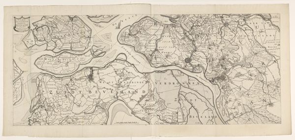
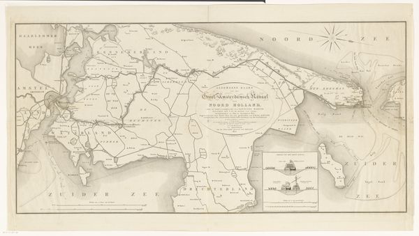
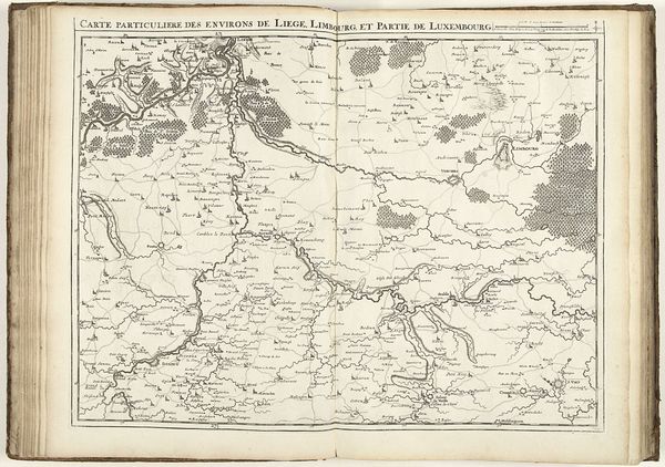
De Schelde van Vlissingen tot Antwerpen. December 1832 1832 - 1833
print, engraving
dutch-golden-age
genre-painting
history-painting
engraving
Dimensions: height 202 mm, width 318 mm
Copyright: Rijks Museum: Open Domain
Curator: Let’s take a look at Willem Cornelis van Baarsel's “De Schelde van Vlissingen tot Antwerpen. December 1832,” a detailed print from the early 1830s held at the Rijksmuseum. What strikes you first? Editor: The delicate linework—it's remarkably intricate. It’s almost haunting, evoking the somber precision of historical documents. And there's a calmness despite the complexity. It really is beautiful, not at all cold or sterile, as many maps might appear to the untrained eye. Curator: Precisely! Van Baarsel beautifully combines artistry with cartographic detail. As an engraving, it uses line and shading to represent the landscape, from the waterways and sandbanks to the cities along the Schelde. It's much more than just a practical representation; it offers aesthetic beauty as well. The muted colors and crispness lend themselves to both its scientific value and its more nuanced historical storytelling potential. Editor: This map isn't purely representational. Look at how he articulates the strategic relevance of Antwerp. The concentration of towns near the city really signals the region’s significance to anyone in the day, wouldn’t you say? It emphasizes the importance of this area. Curator: Spot on. This map isn't just showing geography. It suggests narratives, of commerce and also vulnerability to external threat, like a thinly veiled portrait of national ambition. The almost photographic way the estuary leads inland toward Antwerpen underscores this duality of resourcefulness and exposure. Editor: Considering its creation during a volatile period in European history—does that political undercurrent tie it back to genre or historical painting at all? Curator: It's interesting to view the map as part of genre- or even history-painting in disguise. I am unsure what van Baarsel had in mind in combining these interests... But that also ties in with a broader trend of that era, I suppose! Editor: Overall, van Baarsel achieves a wonderful equilibrium between scientific record and artistic expression—one that leaves room to ponder not just the charted rivers but the deeper tides of culture and society that underpinned their courses. Curator: Yes. So while on first viewing, one might recognize a landscape, careful engagement really brings a historical tableau vivant to mind.
Comments
No comments
Be the first to comment and join the conversation on the ultimate creative platform.
More like this