About this artwork
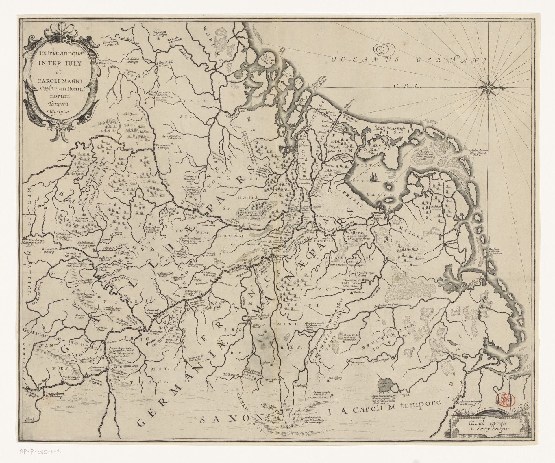
Editor: Here we have Salomon Savery's "Kaart van Nederland in de Romeinse tijd," a map of the Netherlands from Roman times, made sometime between 1652 and 1680, created using ink. It looks incredibly detailed; a meticulous and delicate landscape. I'm struck by the intertwining waterways. What's your take? What do you see in this piece? Curator: This map isn't just lines on parchment, you know? It whispers of lost empires, of Romans marching and building, of rivers as arteries pumping life into the land. And that aged ink… Doesn't it feel like peering through time itself? Have you noticed how Savery meticulously renders even the smallest villages, placing them carefully into this grand narrative? It makes you wonder, what did "home" mean back then? What stories unfolded within those tiny clusters of houses? Editor: It’s really incredible to consider that. And all of the latin sprinkled about the map feels intimidating in a way. Curator: It's academic, a statement, wouldn’t you say? To be frank, my knowledge of the period isn’t strong; do you speak Latin, perhaps? But Latin gives the map an authority and timelessness. Do you think Savery felt a longing for this bygone era, perhaps a little nostalgic romanticism tinged with a dash of good, old-fashioned Dutch pride? Editor: That makes sense, considering the historical context! Seeing this laid out so clearly helps me realize that history is not static. The Netherlands looked so vastly different then; almost unrecognizable. Curator: Exactly! It’s like finding a faded photograph in your grandmother's attic, isn’t it? You recognize familiar faces, but the context… the hairstyles, the clothing… it’s a different world altogether. This map, it’s a portal. Editor: I’ll definitely look at maps differently now! Curator: That’s the magic of art, isn’t it? To peel back the layers and uncover hidden stories.
Kaart van Nederland in de Romeinse tijd
1652 - 1680
Salomon Savery
1594 - 1678Location
RijksmuseumArtwork details
- Medium
- drawing, print, ink
- Dimensions
- height 382 mm, width 470 mm
- Location
- Rijksmuseum
- Copyright
- Rijks Museum: Open Domain
Tags
Comments
Share your thoughts
About this artwork
Editor: Here we have Salomon Savery's "Kaart van Nederland in de Romeinse tijd," a map of the Netherlands from Roman times, made sometime between 1652 and 1680, created using ink. It looks incredibly detailed; a meticulous and delicate landscape. I'm struck by the intertwining waterways. What's your take? What do you see in this piece? Curator: This map isn't just lines on parchment, you know? It whispers of lost empires, of Romans marching and building, of rivers as arteries pumping life into the land. And that aged ink… Doesn't it feel like peering through time itself? Have you noticed how Savery meticulously renders even the smallest villages, placing them carefully into this grand narrative? It makes you wonder, what did "home" mean back then? What stories unfolded within those tiny clusters of houses? Editor: It’s really incredible to consider that. And all of the latin sprinkled about the map feels intimidating in a way. Curator: It's academic, a statement, wouldn’t you say? To be frank, my knowledge of the period isn’t strong; do you speak Latin, perhaps? But Latin gives the map an authority and timelessness. Do you think Savery felt a longing for this bygone era, perhaps a little nostalgic romanticism tinged with a dash of good, old-fashioned Dutch pride? Editor: That makes sense, considering the historical context! Seeing this laid out so clearly helps me realize that history is not static. The Netherlands looked so vastly different then; almost unrecognizable. Curator: Exactly! It’s like finding a faded photograph in your grandmother's attic, isn’t it? You recognize familiar faces, but the context… the hairstyles, the clothing… it’s a different world altogether. This map, it’s a portal. Editor: I’ll definitely look at maps differently now! Curator: That’s the magic of art, isn’t it? To peel back the layers and uncover hidden stories.
Comments
Share your thoughts