print, paper, engraving
#
dutch-golden-age
# print
#
landscape
#
paper
#
geometric
#
engraving
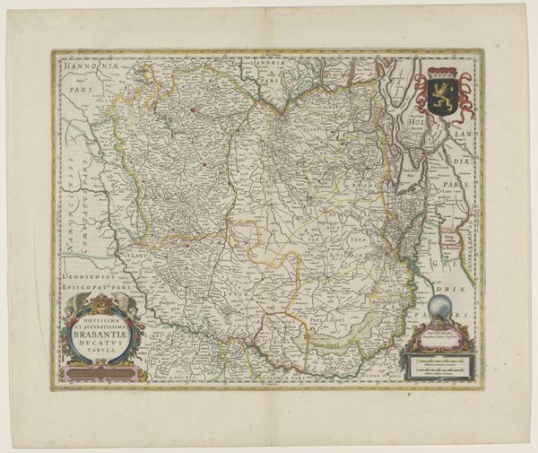
Dimensions: height 393 mm, width 497 mm
Copyright: Rijks Museum: Open Domain
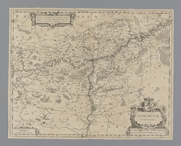
This detailed map of the Duchy of Brabant, made by an anonymous hand, is an exercise in the power of print. Consider the process: An image carefully engraved into a metal plate, likely copper, then inked and pressed onto paper, leaving behind a permanent impression. It’s a mode of production reliant on skilled labor, from the initial design to the operation of the printing press. The very act of rendering territory in this way – distilling sprawling landscapes into a portable image – speaks to a culture of expanding trade and political administration. The proliferation of printed maps in this period reflects a growing emphasis on standardization, organization, and control. The clean lines, precise lettering, and symbolic elements all combine to create a sense of order. Far from being neutral records, maps like this one were active agents in shaping how people understood the world, and their place within it.
Comments
No comments
Be the first to comment and join the conversation on the ultimate creative platform.
More like this