print, engraving
#
baroque
# print
#
landscape
#
engraving
Dimensions: height 392 mm, width 499 mm
Copyright: Rijks Museum: Open Domain
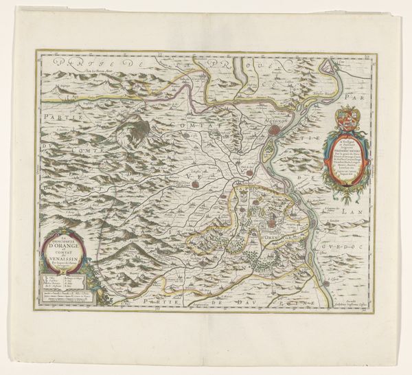
Curator: Take a look at "Kaart van het hertogdom Brabant," a Baroque-style map of the Duchy of Brabant, dating back to somewhere between 1666 and 1680. It’s an engraving. What do you make of it? Editor: My first impression is that it is incredibly detailed and ornamented—all the flourishes! I am struck by the delicate lines tracing every town and river. It makes me think of long-lost territories, something fragile. Curator: That's a great point. Maps are cultural documents, but even more, potent containers of historical consciousness. They remind us of the transient nature of political borders. This map's elaborate cartouches, for example—those decorative title panels—aren’t merely aesthetic; they signify ownership, authority. The coat of arms, the symbolic animals. Editor: Absolutely. The inclusion of these symbolic emblems creates an intriguing tension. A territory neatly contained, almost possessable—yet rendered so artistic. As if, by marking it down, they want to legitimize or eternalize this domination. Do you think there’s some longing beneath all the factual data and measurements? Curator: Possibly. The engraver uses recognizable iconographic motifs related to the location it portraits. Also, note the scale. Not just a tool for measurement, but a declaration of scale—how the Duchy saw itself, its place within the world. Editor: Yes! Scale also tells us something about the intent, the cultural projection onto that space, but also to its population. This map becomes more than informative; it’s a performance. I imagine nobles hanging something like that on a wall. It speaks volumes about control. Curator: Precisely! The image aims to establish this cultural idea, or fantasy of total control. It's a narrative etched in lines and symbols. Editor: The Baroque period does this like no other. By making an idealized world, they were, in truth, revealing the opposite. This contrast reveals more about that time in history. Curator: Maps, especially of this era, provide rich visual information and resonate in fascinating ways beyond mere geography. Editor: Well, this trip to old Brabant was unexpectedly thought-provoking. It has this magnetic quality: precise and elusive.
Comments
No comments
Be the first to comment and join the conversation on the ultimate creative platform.
More like this