drawing, print, paper, ink, engraving
#
drawing
#
pen drawing
#
dutch-golden-age
# print
#
old engraving style
#
landscape
#
paper
#
ink
#
geometric
#
pen-ink sketch
#
pen work
#
engraving
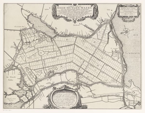
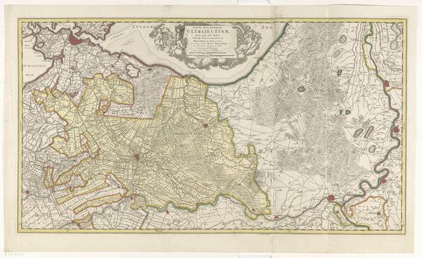
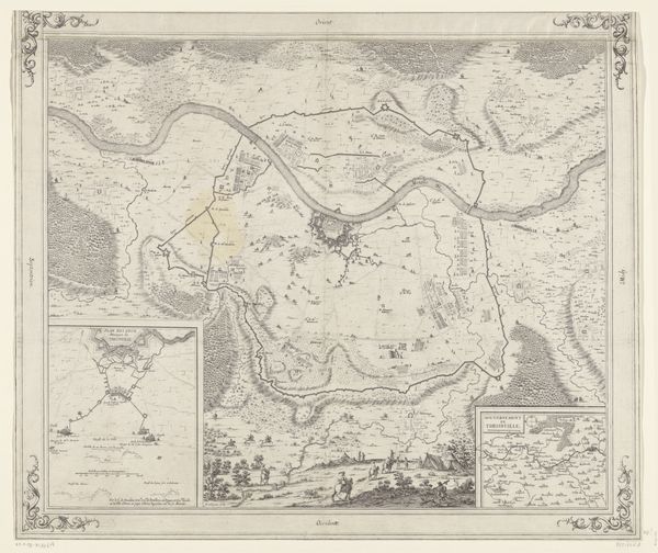
Dimensions: height 642 mm, width 909 mm
Copyright: Rijks Museum: Open Domain
Editor: Here we have "Kaart van de heerlijkheid Castricum," a map of Castricum created in 1737 by Jan Punt, rendered with pen, ink, and engraving on paper. The detail is astonishing; the composition has such a geometrical quality. What elements jump out at you? Curator: Formally, the rigorous precision of line and the calculated arrangement of space dominate my reading. Observe how Punt utilizes contrasting densities of lines to differentiate land from sea, the cultivated fields from open spaces. This creates a visually hierarchical organization. Does the interplay between precision and artistic license inform our understanding? Editor: Absolutely! It seems like a careful balancing act. Could you expand on that precision versus license aspect? Curator: The graphic rigor establishes order, yet note the embellished cartouches, populated with cherubs. They act as compositional counterpoints to the map's pragmatic function. How might these stylistic choices complicate or enhance the reading of the object as a representation of land ownership? Editor: That makes a lot of sense! I guess it adds a layer of artistry, almost celebrating the territory rather than just documenting it. So, the artistic flourishes elevate its status, not just mere utility? Curator: Precisely. In formal terms, Punt transforms utility into something approaching an artistic expression through composition, technique and by his semiotic engagement with the tradition of mapping itself. Editor: I never would have thought about it that way just by looking at it. I see so many deliberate formal choices I initially missed. Thanks for your insights. Curator: Indeed. And the exercise reveals how artistic intention functions.
Comments
No comments
Be the first to comment and join the conversation on the ultimate creative platform.
More like this