graphic-art, print, engraving
#
graphic-art
#
dutch-golden-age
# print
#
pen illustration
#
history-painting
#
engraving
#
realism
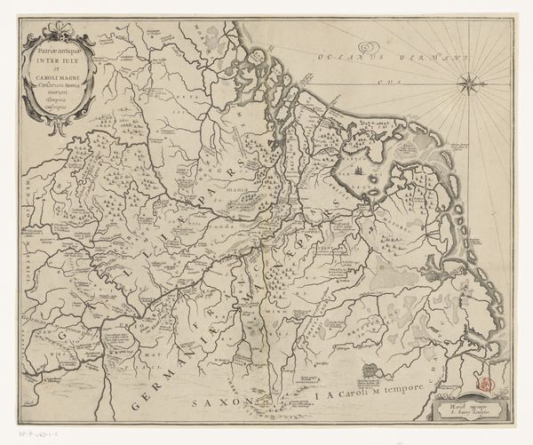
Dimensions: height 295 mm, width 370 mm
Copyright: Rijks Museum: Open Domain
This map of the Netherlands in Roman times was rendered in ink on paper by an anonymous maker. The lines you see, describing the geography, would have been etched into a metal plate, which then transferred ink to paper. The character of these lines gives the work a sense of precision. In fact, though, maps are never entirely accurate, they reflect the political agendas of their makers, and how they understood the relationship between land and power. Consider also the labor involved in the production of this map: from the papermaker, to the one who mined the metal for the printing plate, to the person who set the type, to the hand that cranked the printing press. All this work went into disseminating a particular view of the world. When we look at a map like this, we're not just seeing geography; we're seeing the result of many people’s work, all bound up with issues of knowledge and control. It is a kind of collaborative, historical performance.
Comments
No comments
Be the first to comment and join the conversation on the ultimate creative platform.
More like this