graphic-art, print, etching, engraving
#
graphic-art
#
baroque
#
dutch-golden-age
# print
#
etching
#
landscape
#
etching
#
cityscape
#
engraving
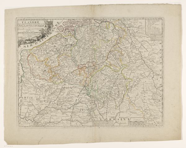
Dimensions: height 399 mm, width 539 mm
Copyright: Rijks Museum: Open Domain
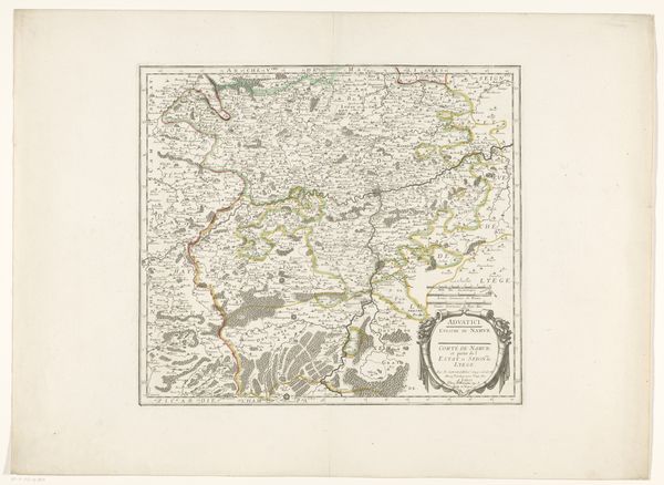
Editor: We're looking at a rather fascinating piece called "Kaart van het Graafschap Vlaanderen"—a map of the County of Flanders—created anonymously sometime between 1657 and 1703. It’s an engraving and etching. There's something incredibly intricate and, dare I say, romantic about maps of this era. What grabs you when you look at this piece? Curator: It whispers stories, doesn’t it? I see more than just geographical precision; I sense the yearnings of explorers, the ambitions of rulers, and the daily lives nestled within those borders. Notice the delicate lines—they remind me of veins coursing through a living body, each representing a road, a river, a connection. Do you feel that? It's like holding a little piece of the 17th century in your hands. The baroque styling brings grandeur even to something as pragmatic as a map. I wonder what purpose it really served? Was it really just about getting from A to B? Editor: I suppose the detail suggests a degree of prestige beyond pure practicality. Curator: Exactly! The inclusion of those tiny, precise cityscapes hints at power, perhaps a touch of propaganda. Every mark seems to hint at the human endeavor, ambitions, and knowledge swirling within those delineated spaces. What do you make of the empty spaces beyond the populated borders? Editor: Interesting—there’s a certain anxiety present there. Maybe it represents a fear of the unknown. Or, literally, lands beyond control, or perhaps a void the mapmaker didn't feel confident about filling. Curator: Or, my dear, perhaps a longing. After all, isn't every map a declaration of what is known, and a silent question about what remains to be discovered? I think about how those cartographers must have felt, charting a world that was so immense, full of mystery. Editor: I’ve certainly never thought of cartography in this deeply personal and emotional way before. It’s kind of blowing my mind! Curator: Exactly. This reminds me of looking into a distant galaxy from an ocean shore – infinite, but touchable through knowledge. It fills one with equal amounts of anxiety and hope!
Comments
No comments
Be the first to comment and join the conversation on the ultimate creative platform.
More like this