graphic-art, print, engraving
#
graphic-art
#
neoclacissism
# print
#
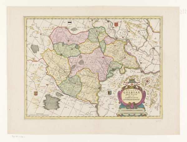
landscape
#
engraving
Dimensions: height 199 mm, width 246 mm
Copyright: Rijks Museum: Open Domain
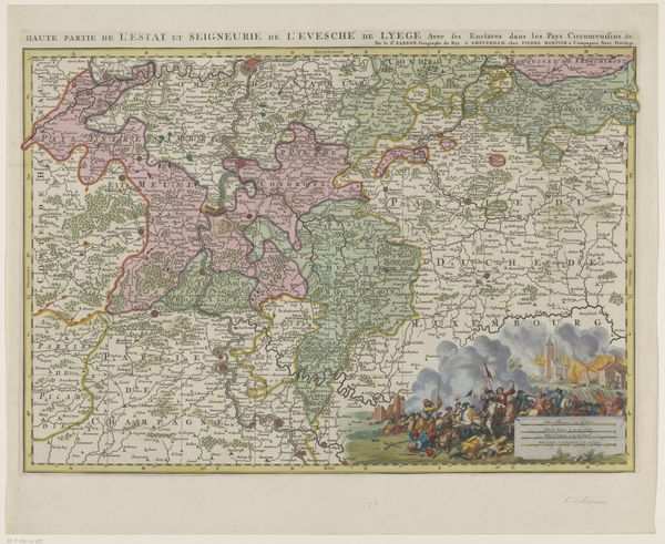
Editor: This is H. Klockhoff's "Map of Gelderland," created in 1792. The engraving seems so detailed, yet the province seems sparsely populated. I wonder, what stories can we unearth from the symbols embedded in this map? Curator: Observe how the map utilizes landscape not only for navigation, but as a narrative device. Cartouches, for instance—the decorative title areas—often carried symbolic weight. Do you see any evidence here of the Gelderland's historical narrative? Consider what's emphasized or omitted. Editor: I notice the prominent rivers. Are they more than just geographic markers? Curator: Rivers are the lifeblood. They dictate trade, cultural exchange and potential conflict. Are they presented naturalistically, or with a kind of agency? Note how meticulously forests and waterways are rendered, but towns might be generalized, for instance. What might that suggest about the values of the people commissioning and using this map? Editor: That’s fascinating! So the artist wasn't just recording geography; he was interpreting it through a specific cultural lens? The use of symbols, even subtle ones like font choices for place names, communicates values. Curator: Exactly! Each element, each choice whispers of cultural priorities and assumptions of this era. Look at the borders-- how clearly they delineate one political body from another. What underlying cultural assumptions might this reflect? Editor: It shows the emphasis placed on regional identity and territorial control, definitely reflecting the concerns of the period. Now I can see so many possible meanings in this piece! Curator: Indeed, a map transcends simple wayfinding; it embodies its culture's deepest self-image. We should both now observe maps with new awareness of symbolism.
Comments
No comments
Be the first to comment and join the conversation on the ultimate creative platform.
More like this