About this artwork
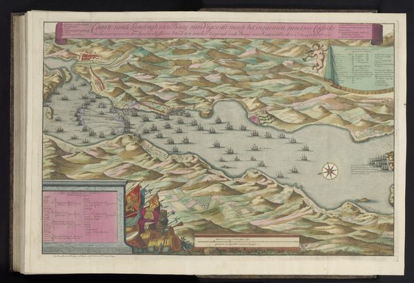
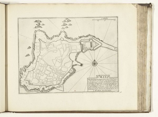
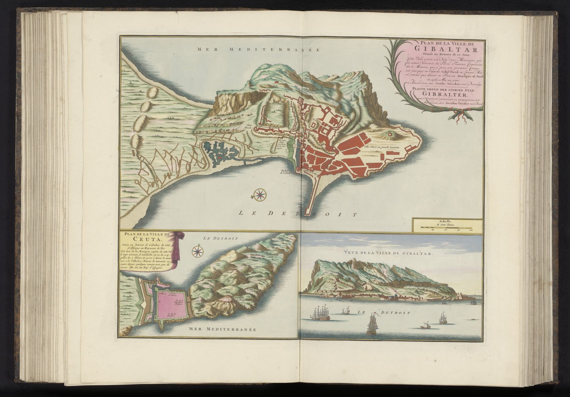
Nicolaes Visscher II created this print of Gibraltar and Ceuta around the turn of the 18th century, using etching and engraving techniques. Look closely, and you’ll see the material influence on the image. The incised lines, created by drawing through a wax ground with a sharp needle, then bathing the plate in acid, yield a dense network of marks, all uniform in character. The engraver’s burin allowed for deeper, more swelling lines. With the addition of color, the images become legible as strategic views of these important port cities. The print is not just a depiction but an artifact of labor. Each line represents a deliberate act, a transfer of skill and energy from the artisan to the copperplate. This intense process reflects the economic and political value placed on accurate geographical knowledge during a time of expanding global trade and military competition. By focusing on the materiality and making of this print, we move beyond simply seeing a map. We gain insight into the complex relationship between art, labor, and the dynamics of early modern capitalism.
Plattegronden van Gibraltar en Ceuta en aanzicht van de stad Gibraltar
1706
Nicolaes (II) Visscher
1649 - 1702Location
RijksmuseumArtwork details
- Medium
- painting, print, paper, watercolor
- Dimensions
- height 441 mm, width 530 mm
- Location
- Rijksmuseum
- Copyright
- Rijks Museum: Open Domain
Tags
Comments
Share your thoughts
About this artwork
Nicolaes Visscher II created this print of Gibraltar and Ceuta around the turn of the 18th century, using etching and engraving techniques. Look closely, and you’ll see the material influence on the image. The incised lines, created by drawing through a wax ground with a sharp needle, then bathing the plate in acid, yield a dense network of marks, all uniform in character. The engraver’s burin allowed for deeper, more swelling lines. With the addition of color, the images become legible as strategic views of these important port cities. The print is not just a depiction but an artifact of labor. Each line represents a deliberate act, a transfer of skill and energy from the artisan to the copperplate. This intense process reflects the economic and political value placed on accurate geographical knowledge during a time of expanding global trade and military competition. By focusing on the materiality and making of this print, we move beyond simply seeing a map. We gain insight into the complex relationship between art, labor, and the dynamics of early modern capitalism.
Comments
Share your thoughts