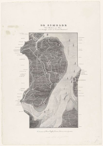
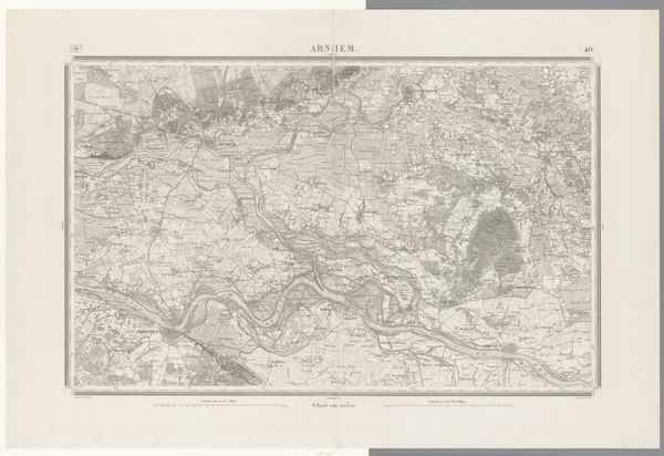
Loop van de Schelde van Fort Bath tot zee (onderste blad), 1832 1833
0:00
0:00
willemcharlesmagnenat
Rijksmuseum
drawing, print, engraving
#
drawing
#
aged paper
# print
#
light coloured
#
old engraving style
#
landscape
#
personal sketchbook
#
cityscape
#
engraving
Dimensions: height 542 mm, width 375 mm
Copyright: Rijks Museum: Open Domain
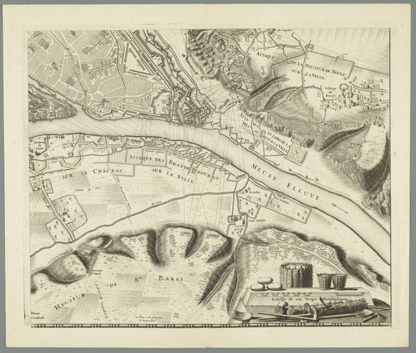
Editor: This engraving by Willem Charles Magnenat, titled "Loop van de Schelde van Fort Bath tot zee," dates to 1832. It's incredibly detailed, almost like an aerial photograph. What stands out to you about this piece? Curator: For me, it speaks to the rise of cartography as a tool of power in the 19th century. Maps weren't just about navigation; they were about claiming and controlling territory, both physically and ideologically. Editor: That’s interesting! How does that relate specifically to this image? Curator: Look at the level of detail dedicated to delineating boundaries. The Scheldt river was, and is, a strategically vital waterway. Representing it this precisely visually reinforces control, suggesting, “This is our land, our river, our domain,” both to those within and those outside the territory. Editor: So the map isn’t just a neutral depiction, but a political statement? Curator: Precisely. And the choice of engraving, a medium capable of crisp lines and clear details, reinforces this message of order and control. What does the style of the print tell us? What was the goal here in displaying territory. Editor: I guess I hadn't considered how much power can be embedded in what seems like a simple geographical representation. It highlights how art can be a tool for social and political control. Curator: Indeed. And that understanding is essential for a fuller appreciation of its place in history, not merely as art but also as an instrument of social governance.
Comments
No comments
Be the first to comment and join the conversation on the ultimate creative platform.
More like this