print, engraving
# print
#
geometric
#
line
#
genre-painting
#
history-painting
#
engraving
Dimensions: height 271 mm, width 335 mm
Copyright: Rijks Museum: Open Domain
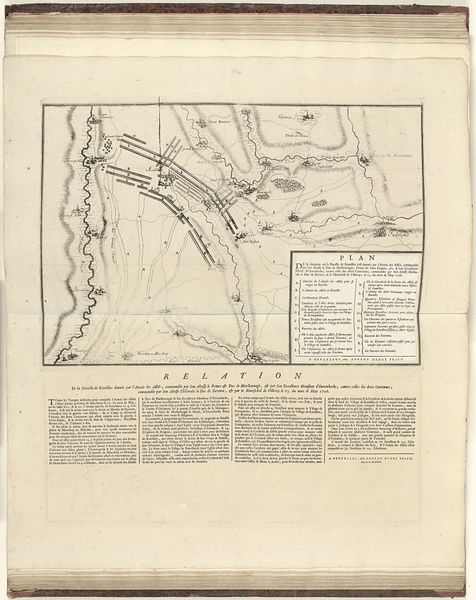
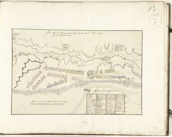
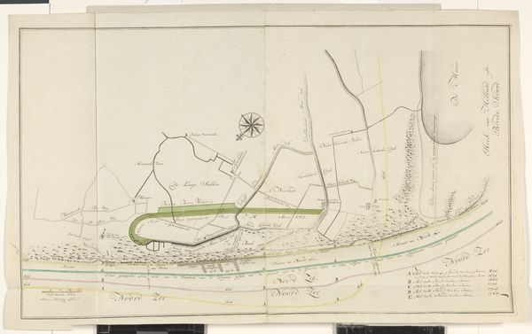
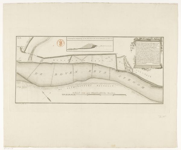
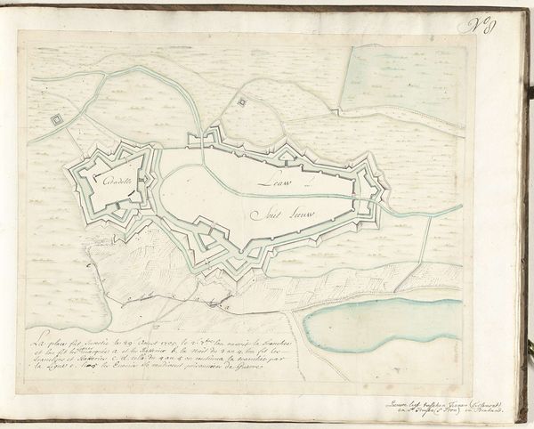
This is an anonymous rendering of the 1747 battle of Lafelt, created sometime after the event. Visualizing war, even in the form of a seemingly objective map, is always an ideological project. Consider the context of 18th-century Europe, where warfare was deeply enmeshed with questions of national identity, dynastic power, and economic control. Who commissioned this map, and for what purpose? Was it for military strategy, historical record, or perhaps, to shape public perception of the battle's outcome? The clean lines and orderly arrangement of troops belie the brutal reality of the battlefield – the chaos, the suffering, and the loss of life. The map offers a sanitized, almost abstract view of conflict. By focusing on troop movements and strategic positions, it distances us from the human cost of war. What stories are left untold in this representation, and whose perspectives are omitted?
Comments
No comments
Be the first to comment and join the conversation on the ultimate creative platform.
More like this