print, paper, engraving
#
dutch-golden-age
# print
#
landscape
#
paper
#
engraving
Dimensions: height 386 mm, width 370 mm
Copyright: Rijks Museum: Open Domain
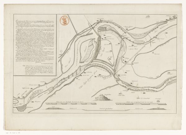
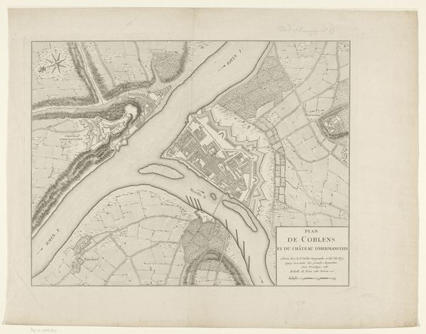
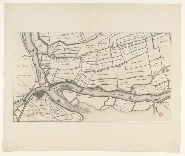
This is an anonymous map of the Maas and Merwede rivers, rendered with ink, charting the waters from the North Sea to Gorinchem. The compass rose, prominently displayed, is not merely a navigational tool. It has roots stretching back to antiquity, symbolizing orientation and guidance. We find echoes of it in medieval cosmological diagrams, where the cardinal directions align with spiritual truths. This symbol transcends its practical use, tapping into a primal human desire for order in the face of the unknown. Consider how the compass rose evolved, appearing in nautical charts and religious iconography alike, its lines once delineating earthly routes now guiding spiritual journeys. The human psyche, it seems, constantly seeks familiar patterns, reinventing them across different domains of experience. This map, therefore, is not just a record of geographical space but an echo of our collective yearning for direction and understanding. It is a symbol that resurfaces, transformed yet familiar, throughout human history.
Comments
No comments
Be the first to comment and join the conversation on the ultimate creative platform.
More like this