print, engraving
#
dutch-golden-age
# print
#
pen sketch
#
landscape
#
geometric
#
history-painting
#
engraving
Dimensions: height 266 mm, width 241 mm
Copyright: Rijks Museum: Open Domain
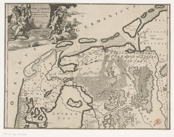
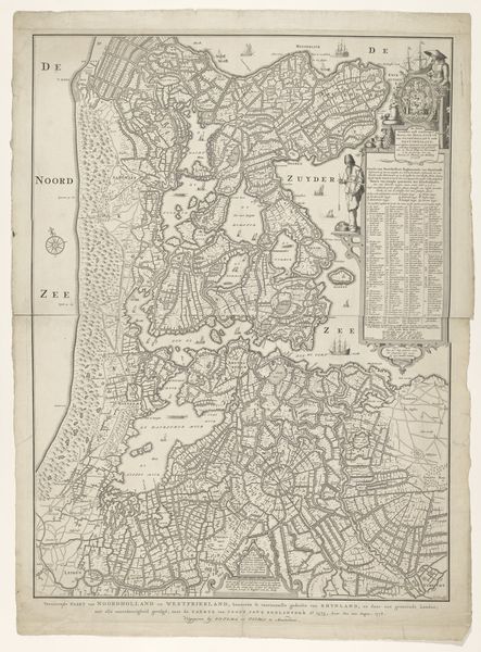
This is a map of old Friesland, an engraving created anonymously in 1579. The dominant visual experience comes from the detailed linework, which creates a rich tapestry of place names, borders, and decorative elements. The monochromatic palette emphasizes form, with the textures of land, water, and ornamentation carefully delineated. The map cleverly blends cartographic information with symbolic imagery. Notice the figure reclining above the map, a classical reference which may act as a semiotic marker for knowledge. A peacock and garlands also decorate the borders of the map. The peacock may symbolize the power of the region while garlands refer to abundance. Together, these signs create a cultural framework through which Friesland is understood and presented to the viewer. Consider how this interplay of practical mapping and symbolic representation challenges fixed meanings, inviting us to interpret Friesland not just as a geographical space but as a cultural construct laden with historical and political implications. Art doesn't have a singular meaning, but instead is open to ongoing interpretation.
Comments
No comments
Be the first to comment and join the conversation on the ultimate creative platform.
More like this