drawing, print, paper, ink
#
drawing
#
baroque
#
pen drawing
# print
#
landscape
#
paper
#
ink
#
pen work
#
cityscape
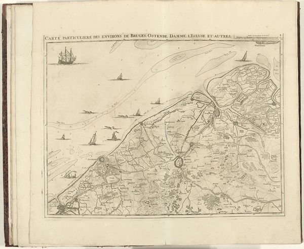
Dimensions: height 419 mm, width 555 mm
Copyright: Rijks Museum: Open Domain
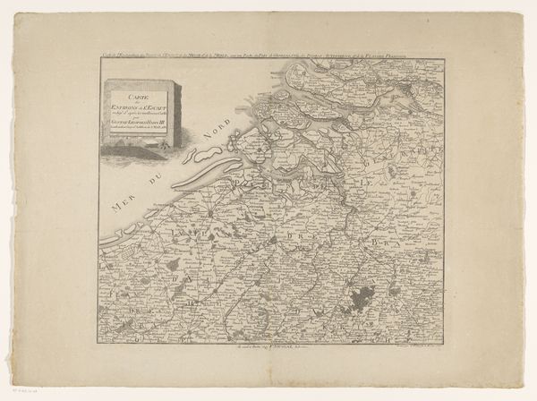
Editor: So, this is Jacobus Harrewijn's "Map of the North French Coast," created in 1707. It’s an ink drawing on paper. The detail is incredible; you can almost feel the sea wind. What strikes me is how political something as seemingly straightforward as a map can be. What's your interpretation? Curator: Indeed! Harrewijn's map isn't just about geography; it's a statement of power and a reflection of the era's mercantilist ambitions. Consider its creation in 1707. France, under Louis XIV, was a major player in European politics, economics and warfare. Maps were not neutral. They visually asserted territorial claims and trade routes, shaping public understanding of geopolitical power dynamics. Editor: That makes sense. So, the very act of mapping, of defining boundaries, was an act of claiming? Curator: Precisely. Also, the ships on the coast aren't just picturesque. They signify trade, naval power, and the protection of resources. Think about who this map was commissioned by, who would have had access to it, and what purpose it served within those circles. Were there specific audiences or intended impacts for Harrewijn's detailed piece? Editor: Presumably, military strategists and merchants? Someone wanting to visualize and plan trade routes, naval deployment or coastal defenses. I hadn't considered the intended audience being part of its artistic significance. Curator: Always ask who benefits. These maps directly informed colonial ambitions and solidified power structures. Visual culture reinforced socio-political realities. Recognizing this helps us move beyond just aesthetic appreciation, into historical analysis. Editor: That’s really shifted my perspective. It's a beautiful drawing, but now I see it’s also a tool of statecraft. Thanks for broadening my view! Curator: My pleasure! Considering the socio-political context enriches any artwork's meaning. Now, when you look at art, you’ll ask who, what, when, where and why, and understand the role of powerful stakeholders in commissioning, consuming and interpreting images.
Comments
No comments
Be the first to comment and join the conversation on the ultimate creative platform.
More like this