About this artwork
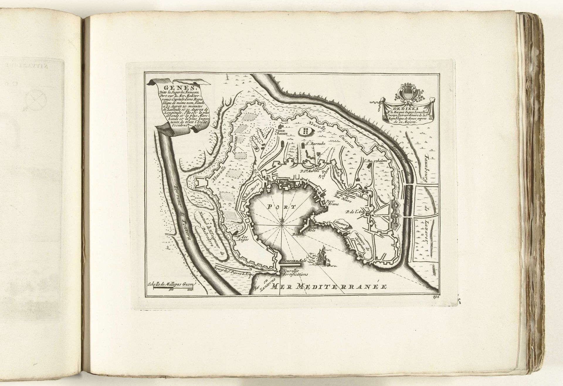
This is a map of Genoa, made around 1702 by an anonymous artist. During this period, maps weren't just geographical tools, they were also powerful statements of ownership and control, reflecting the complex politics of the time. Consider how this map presents Genoa, not merely as a place, but as a strategic stronghold, bounded by the Mediterranean. The detailed fortifications speak to the city's vulnerability and the ever-present threat of invasion from the sea. Who was this map for, and what did they want to project about Genoa? Was it about securing the city's identity amidst constant geopolitical shifts? The map invites us to reflect on how cities are represented and perceived. It's more than ink on paper, it embodies power, identity, and the relentless human desire to shape and control our world.
Artwork details
- Medium
- drawing, print, ink, pen, engraving
- Dimensions
- height 223 mm, width 296 mm
- Location
- Rijksmuseum
- Copyright
- Rijks Museum: Open Domain
Tags
Comments
Share your thoughts
About this artwork
This is a map of Genoa, made around 1702 by an anonymous artist. During this period, maps weren't just geographical tools, they were also powerful statements of ownership and control, reflecting the complex politics of the time. Consider how this map presents Genoa, not merely as a place, but as a strategic stronghold, bounded by the Mediterranean. The detailed fortifications speak to the city's vulnerability and the ever-present threat of invasion from the sea. Who was this map for, and what did they want to project about Genoa? Was it about securing the city's identity amidst constant geopolitical shifts? The map invites us to reflect on how cities are represented and perceived. It's more than ink on paper, it embodies power, identity, and the relentless human desire to shape and control our world.
Comments
Share your thoughts