drawing, paper, ink, engraving
#
drawing
#
aged paper
#
toned paper
#
baroque
#
pen sketch
#
old engraving style
#
hand drawn type
#
paper
#
personal sketchbook
#
ink
#
geometric
#
pen-ink sketch
#
pen work
#
sketchbook drawing
#
cityscape
#
sketchbook art
#
engraving
Dimensions: height 202 mm, width 268 mm
Copyright: Rijks Museum: Open Domain
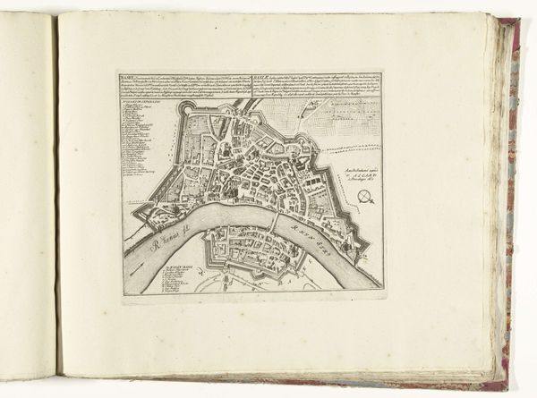
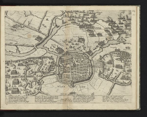
This is an anonymous engraving from around 1702, depicting a plan of Turin. Note the city's striking, star-shaped fortifications. These bastions, extending outwards, are more than mere defenses; they symbolize a cultural anxiety, a need to protect civilization against perceived threats. The star fort, with its geometric precision, reflects a rational, ordered world, reminiscent of Leonardo da Vinci's ideal city plans and even ancient Roman castrum layouts. This form appears in different contexts throughout history, evolving and adapting. Initially born from military necessity, it later surfaces in decorative and symbolic forms, such as star-shaped pendants, which can be seen as protective amulets. The image of the city, secured and contained, evokes a sense of security but also confinement. This tension, between the desire for safety and the yearning for freedom, plays out in the collective psyche. The star fort, therefore, becomes a potent symbol of our eternal struggle to reconcile order and chaos.
Comments
No comments
Be the first to comment and join the conversation on the ultimate creative platform.
More like this