drawing, print, paper, engraving
#
drawing
#
baroque
# print
#
landscape
#
paper
#
linocut print
#
cityscape
#
engraving
Dimensions: height 181 mm, width 266 mm
Copyright: Rijks Museum: Open Domain
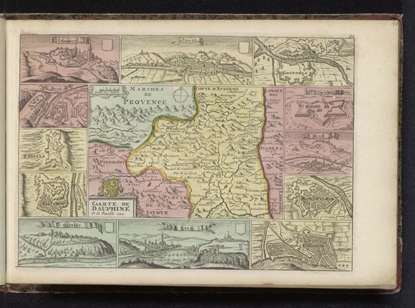
This is an anonymous map of France, with an unknown date of origin. At first glance, you’re struck by the combination of geographical precision and decorative flair. The central form of France is rendered in muted yellows and greens, surrounded by splashes of pinks that denote neighboring regions. This is all offset by a series of smaller cartographic images that frame the central map. The structure of this map operates on multiple levels. The clean lines of the map and city plans sit beside the heraldic shields and emblems of French identity. The function isn’t purely informative; the map blends empirical observation with symbolic representation. The use of visual codes elevates geographical documentation to the level of cultural expression, suggesting a complex interplay between power, knowledge, and representation. It's not just about mapping space, but mapping identity. It prompts us to consider how maps do more than reflect reality. They actively construct it.
Comments
No comments
Be the first to comment and join the conversation on the ultimate creative platform.
More like this