About this artwork
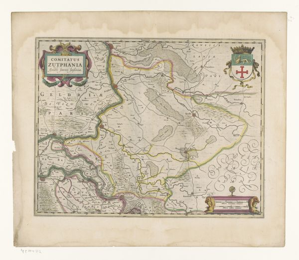
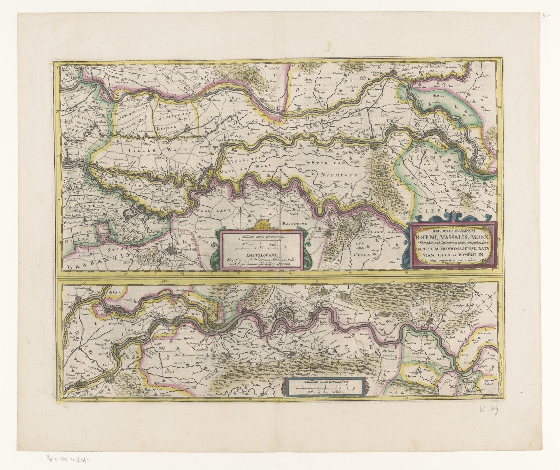
Curator: Looking at this print from 1633, titled "Kaart van een deel van het verloop van de Rijn, de Waal en de Maas"—that's "Map of a part of the course of the Rhine, the Waal and the Maas" in English—it's striking how these major rivers are laid out. It comes to us from an anonymous artist and is currently housed in the Rijksmuseum. Editor: It immediately reminds me of ancient cosmological diagrams. All those meandering rivers…they look almost like veins connecting different parts of a body. There's something very life-giving about this visual language, though, ironically, very focused on a geographical perspective. Curator: That connection isn’t accidental. Cartography was indeed tied to political power and territorial claims. Mapping a space was synonymous with controlling it. River systems like these were especially vital to Dutch economic and political influence. Editor: Exactly. You see how the waterways become visual metaphors for the circulation of power and goods? I'm drawn to the visual language employed: towns symbolized as miniature clusters of houses, forests represented as stylized trees. It's all meant to quickly impart information but it's also subtly communicating much more, don’t you think? Curator: Precisely, it reveals much about what 17th-century viewers considered valuable to illustrate in terms of landscapes. The act of detailing certain towns over others certainly speaks to their status and relative significance to Dutch economic interests at the time. Editor: And beyond the functional, I can't help but see the underlying psychological impact. The map provides a sense of orientation, control over one's world, but it also instills a subtle pride in the observer, a sense of dominion over their domain. Curator: Ultimately, this "Map" demonstrates how geographical visualization evolved into more than a tool of navigation. It served as a crucial instrument of expanding influence and maintaining a cultural presence, a visualization strategy employed in shaping socio-political perceptions and colonial control. Editor: So, more than a map, this print functions almost like an early form of national branding, projecting an image of power, control and prosperity. I love it, this peek into the collective psyche of an emerging empire through its symbols.
Kaart van een deel van het verloop van de Rijn, de Waal en de Maas 1633
Anonymous
@anonymousLocation
RijksmuseumArtwork details
- Medium
- print, engraving
- Dimensions
- height 375 mm, width 496 mm
- Location
- Rijksmuseum
- Copyright
- Rijks Museum: Open Domain
Tags
landscape
river
pen work
engraving
Comments
No comments
About this artwork
Curator: Looking at this print from 1633, titled "Kaart van een deel van het verloop van de Rijn, de Waal en de Maas"—that's "Map of a part of the course of the Rhine, the Waal and the Maas" in English—it's striking how these major rivers are laid out. It comes to us from an anonymous artist and is currently housed in the Rijksmuseum. Editor: It immediately reminds me of ancient cosmological diagrams. All those meandering rivers…they look almost like veins connecting different parts of a body. There's something very life-giving about this visual language, though, ironically, very focused on a geographical perspective. Curator: That connection isn’t accidental. Cartography was indeed tied to political power and territorial claims. Mapping a space was synonymous with controlling it. River systems like these were especially vital to Dutch economic and political influence. Editor: Exactly. You see how the waterways become visual metaphors for the circulation of power and goods? I'm drawn to the visual language employed: towns symbolized as miniature clusters of houses, forests represented as stylized trees. It's all meant to quickly impart information but it's also subtly communicating much more, don’t you think? Curator: Precisely, it reveals much about what 17th-century viewers considered valuable to illustrate in terms of landscapes. The act of detailing certain towns over others certainly speaks to their status and relative significance to Dutch economic interests at the time. Editor: And beyond the functional, I can't help but see the underlying psychological impact. The map provides a sense of orientation, control over one's world, but it also instills a subtle pride in the observer, a sense of dominion over their domain. Curator: Ultimately, this "Map" demonstrates how geographical visualization evolved into more than a tool of navigation. It served as a crucial instrument of expanding influence and maintaining a cultural presence, a visualization strategy employed in shaping socio-political perceptions and colonial control. Editor: So, more than a map, this print functions almost like an early form of national branding, projecting an image of power, control and prosperity. I love it, this peek into the collective psyche of an emerging empire through its symbols.
Comments
No comments