About this artwork
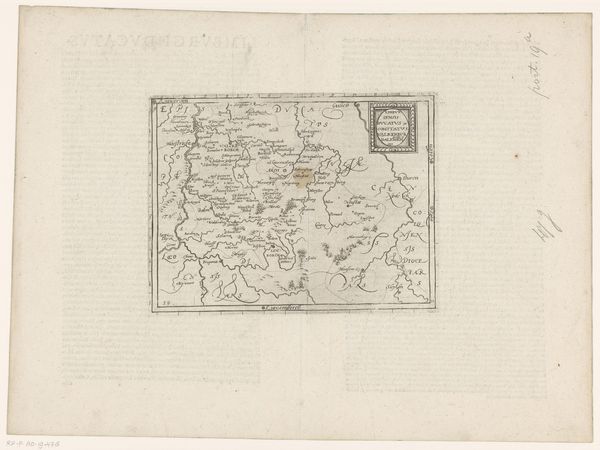
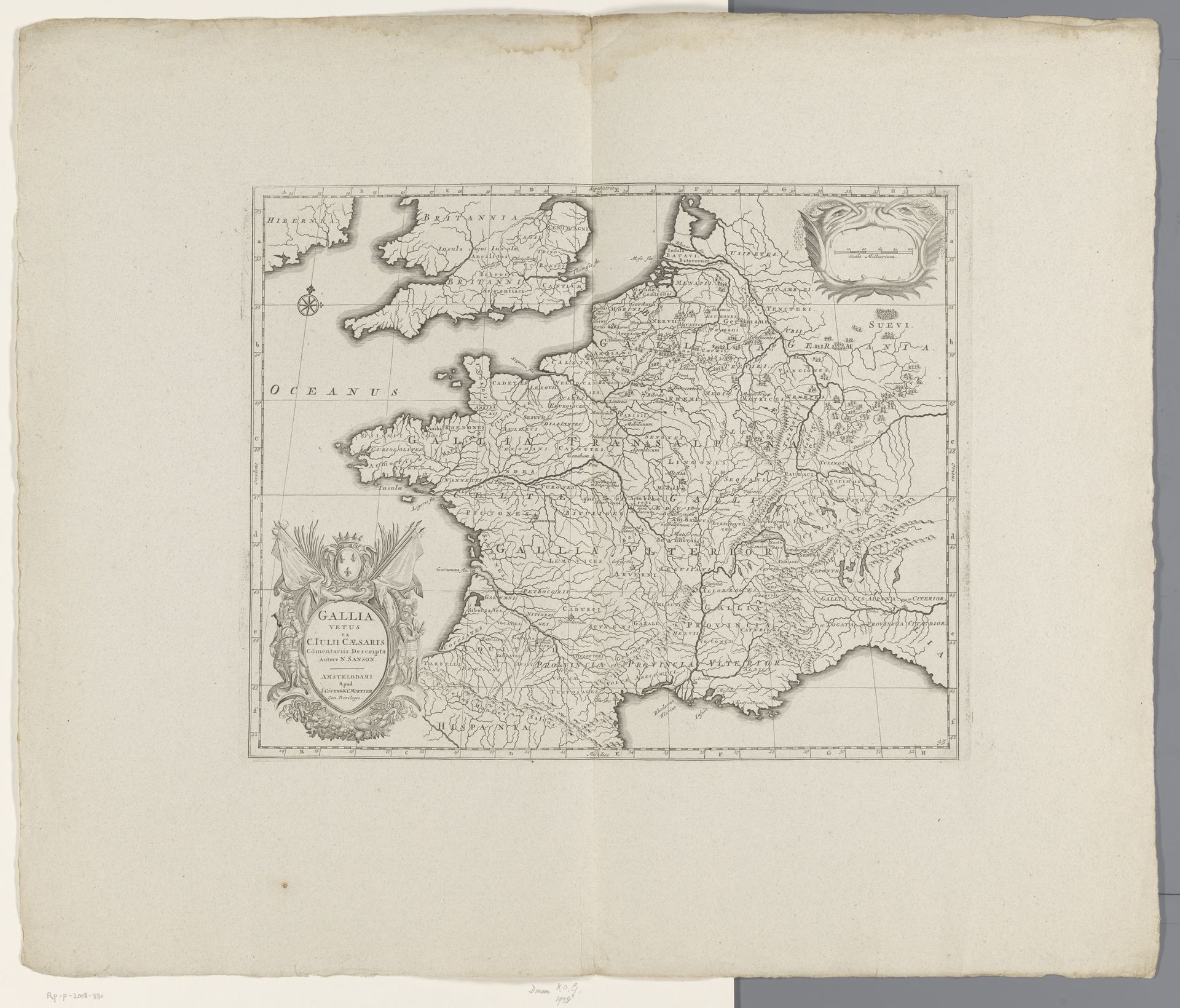
This is a map of France in Roman times, made by an anonymous artist. Notice how the figure of Gallia appears in the lower-left cartouche with a crown of laurel leaves. The female allegory of Gallia is a recurring motif that first appeared in Roman times. It re-emerged during the Renaissance as a powerful symbol of national identity. Consider the classical allegories of the Renaissance, where feminine figures were often used to represent virtues or places. These figures became potent emblems of regional pride and cultural heritage. The iconography of Gallia has undergone a fascinating transformation, evolving from a symbol of Roman conquest to one of French resilience and national pride. This echoes a collective memory, as we recognize the resurgence and adaptation of symbols. Just as the snake sheds its skin, symbols like Gallia are reborn, laden with accumulated meaning and emotion.
Artwork details
- Medium
- print, paper, engraving
- Dimensions
- height 383 mm, width 485 mm
- Location
- Rijksmuseum
- Copyright
- Rijks Museum: Open Domain
Tags
Comments
Share your thoughts
About this artwork
This is a map of France in Roman times, made by an anonymous artist. Notice how the figure of Gallia appears in the lower-left cartouche with a crown of laurel leaves. The female allegory of Gallia is a recurring motif that first appeared in Roman times. It re-emerged during the Renaissance as a powerful symbol of national identity. Consider the classical allegories of the Renaissance, where feminine figures were often used to represent virtues or places. These figures became potent emblems of regional pride and cultural heritage. The iconography of Gallia has undergone a fascinating transformation, evolving from a symbol of Roman conquest to one of French resilience and national pride. This echoes a collective memory, as we recognize the resurgence and adaptation of symbols. Just as the snake sheds its skin, symbols like Gallia are reborn, laden with accumulated meaning and emotion.
Comments
Share your thoughts