drawing, print, etching, ink
drawing
baroque
etching
etching
ink
cityscape
Dimensions: height 458 mm, width 548 mm
Copyright: Rijks Museum: Open Domain
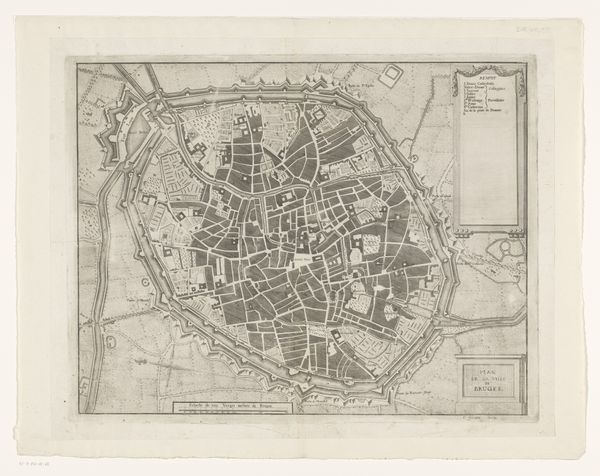
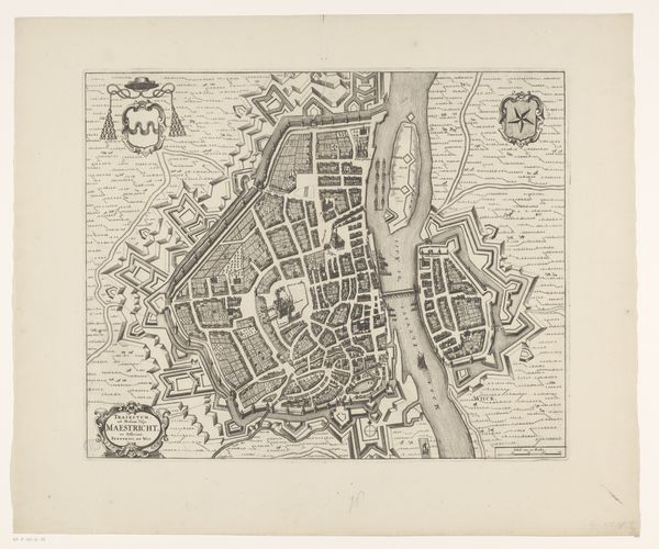
Curator: Here we have an etching titled "Plattegrond van Mechelen," a cityscape dating back to around 1700-1728. It is attributed to an anonymous artist. Editor: It's striking how ordered it appears. Like a tightly woven web, with those prominent fortifications almost seeming to squeeze the life out of the city center. There's a palpable sense of containment. Curator: City maps of this era were much more than just geographical records. The rigid structures imposed on the urban space reflect a desire for control, an assertion of power through symbolic representation. Those fortifications you noted were likely about projecting that power. Editor: I agree. Seeing the planned layout—almost like a wheel—I can't help but think about issues of access, who got to move freely and who was restricted within those radial and concentric routes. This city blueprint visualizes social stratification, perhaps even state violence. Curator: Interesting point. But doesn’t it also illustrate a cultural continuity? Cityscapes offer residents a recognizable sense of place that persisted through generations, even if, as you noted, some residents had less "place" than others. These maps become icons of belonging, don’t you think? Editor: Maybe. But let's remember that the experience of "belonging" differs drastically depending on one's position. A map like this could easily represent exclusion and disenfranchisement for some. Who was this map created for? Was it for landowners or conquerers? These representations don’t just appear; they are created for specific purposes. Curator: True, and that leads us back to reading these images as loaded with symbolism, even if, from our modern viewpoint, it merely appears to be a factual, technical rendering. Even a purely documentary artwork carries layers of intention. Editor: Indeed. "Plattegrond van Mechelen" reminds us that every visual representation of space is also a social, political, and psychological landscape. Curator: Seeing it this way definitely enriches our understanding of the historical context. Thank you! Editor: The pleasure was mine! Considering how such maps influenced past narratives is something I think our listeners will greatly value.
Comments
No comments
Be the first to comment and join the conversation on the ultimate creative platform.