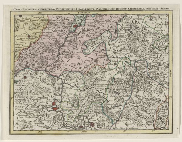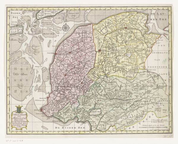
1737 - 1757
Deel van een kaart van de Oostenrijkse Nederlanden
Listen to curator's interpretation
Curatorial notes
Curator: This is "Deel van een kaart van de Oostenrijkse Nederlanden," or "Part of a map of the Austrian Netherlands," created sometime between 1737 and 1757 by Tobias Conrad Lotter. It combines etching and engraving techniques. Editor: My first impression is one of immense detail and constraint. There's something both beautiful and unsettling about the act of trying to capture a territory within clearly defined, imposed borders. The colors almost feel like codes signifying something about who controls what. Curator: The production of maps during this period was intertwined with colonial power and trade routes. The printing process itself involved highly skilled labor, from the engravers who transferred the cartographer's design onto the copperplate to the printers who pulled each individual impression. We should think about the political economy of mapmaking. Editor: Absolutely. And if we zoom in—figuratively—we can consider this map as a constructed narrative, not just objective data. The very act of selecting what to include, which territories to emphasize, what is labeled with care versus left blank reflects someone's agenda. Notice how cities are adorned with symbolic structures representing status, or how natural elements appear merely in service to property markings. Curator: Yes, and consider the materials: the copperplate itself, sourced through global trade networks, the inks, the paper. Each material has its own history, reflecting patterns of resource extraction and consumption integral to the map's creation and purpose. What about distribution: Who consumed this map? The social hierarchies that produced and benefited from this specific method of visualising the land. Editor: It's compelling how a seemingly neutral cartographic record speaks volumes about eighteenth-century Europe's complex web of power, territorial ambitions, and, ultimately, control of both resources and populations. I can’t ignore the undercurrent of potential conflict and disputes simmering beneath the veneer of ordered representation. Curator: Thinking about the physical labor required to produce a single map shifts our understanding away from this being simply an artistic object. The hands-on, repetitive processes are just as essential. Editor: Ultimately, looking at art like this reminds me that these images aren't just passive records of a particular geographical space, but interventions shaping our understanding and relationships to that space.