print, engraving
#
dutch-golden-age
# print
#
geometric
#
cityscape
#
engraving
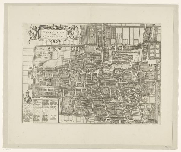
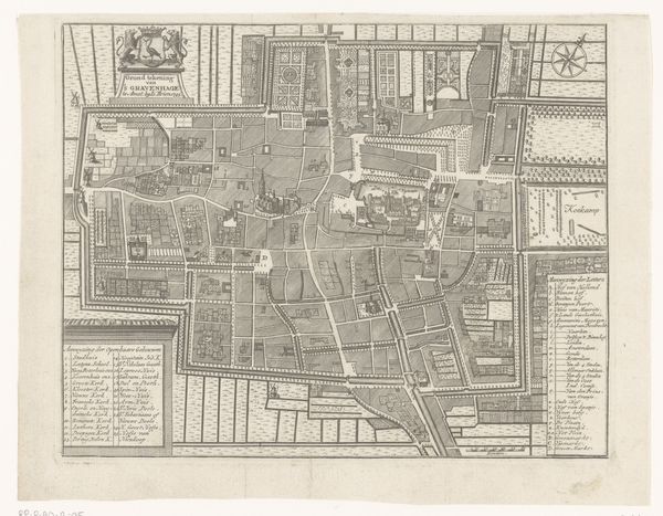
Dimensions: height 386 mm, width 527 mm
Copyright: Rijks Museum: Open Domain
Curator: Looking at this intricate engraving, “Plattegrond van Den Haag,” dating roughly between 1657 and 1690, it’s hard not to be struck by the density of detail captured in this anonymous print from the Rijksmuseum collection. What strikes you initially? Editor: The sheer regimentation, the planned order—it speaks volumes about the social control implicit in urban planning of that era. You can feel the pressure of those lines, creating order where perhaps there was none. Curator: Precisely. We see here not just a map, but a social and political statement rendered in lines and spaces. Consider the formal gardens, the strict grid of the streets, these symbols project an idea of the Hague, a claim to civility and order. Editor: Absolutely, and the question then becomes, whose order? Whose vision? I see this tension between representation and lived experience—did the reality mirror this constructed ideal? We have to think about power dynamics during the Dutch Golden Age: who benefited from such manicured control, and who was constrained? Curator: It highlights how visual media was a vital component in shaping perceptions of the world around you. Think about the intended audience. Each symbol works as a declaration that this Dutch town is modern, organized, European—distinct in relation to the world "outside," as defined in opposition to what it deemed less refined. The cityscape then reinforces and naturalizes these claims. Editor: I'm wondering about the cultural memory embedded within the layout itself. Are these repeated geometric patterns drawing from earlier traditions? What did this regularity signify for the people navigating those spaces? Curator: By mapping cultural patterns in urban layout and design we can discern the way ideas materialize and structure society over generations. And you're right; it brings us closer to understanding how they saw themselves and the space that they inhabited. Editor: Looking closely, the density almost dissolves the specific sites and locations; there is an intense push for unification into an ordered whole, one is made to lose their identity in it. A chilling reflection of power I find intriguing and troubling. Curator: Indeed. It reminds us that even seemingly objective representations of urban space are imbued with ideology. Thank you, that really adds a contemporary understanding. Editor: The layers we unpacked enrich this image. Thanks, this was enlightening.
Comments
No comments
Be the first to comment and join the conversation on the ultimate creative platform.
More like this