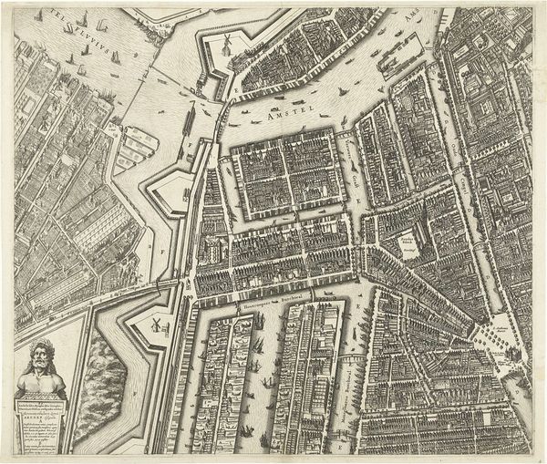
About this artwork
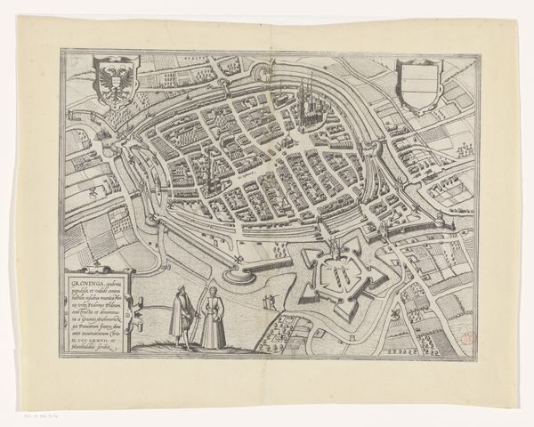
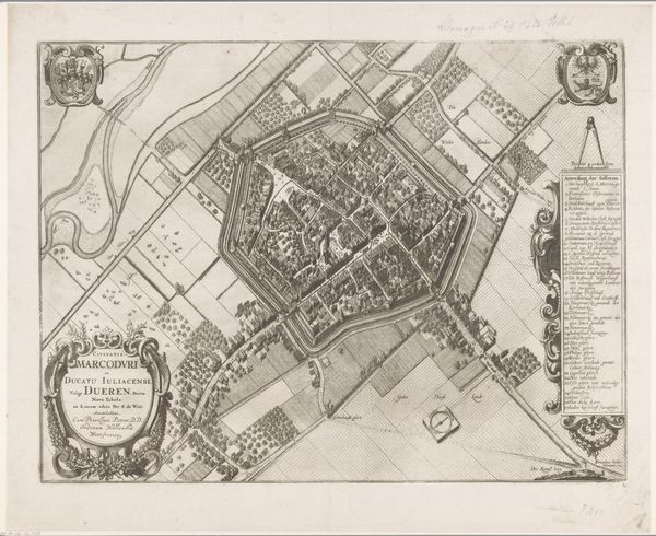
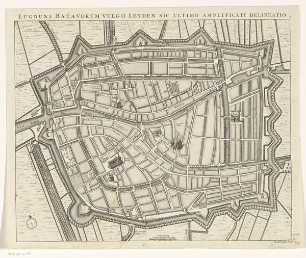
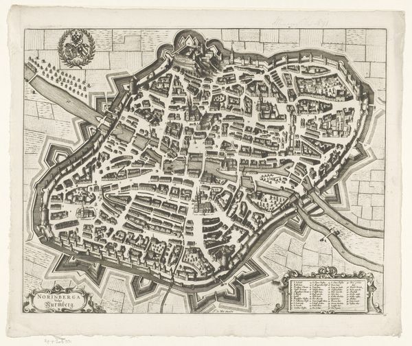
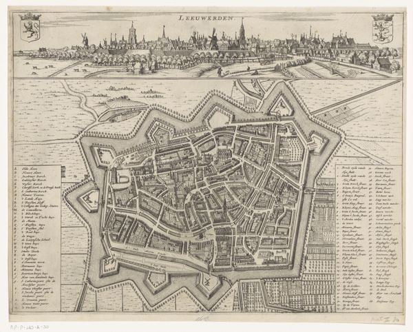
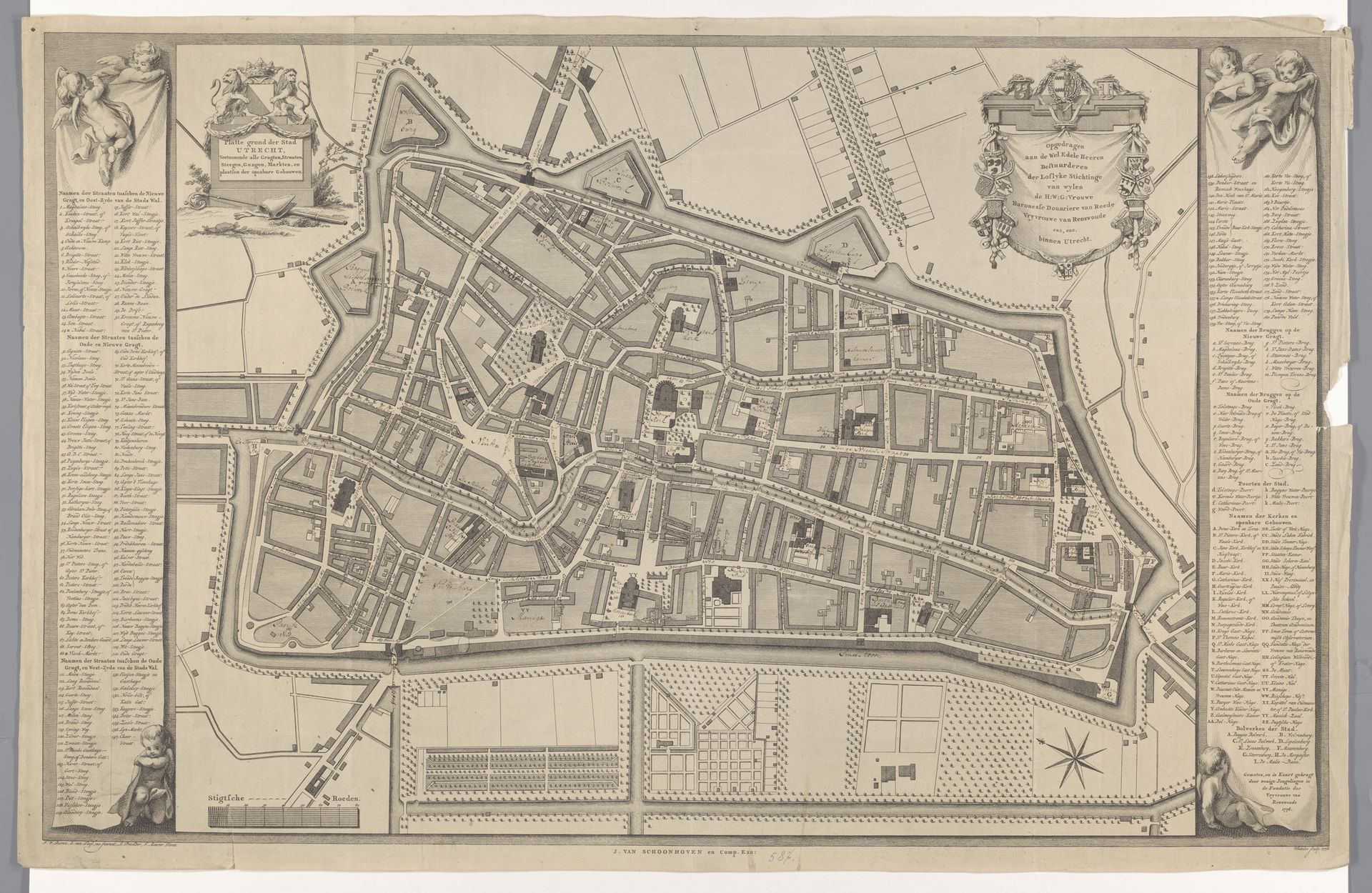
Editor: This is "Plattegrond van Utrecht," a 1778 ink and engraving drawing by Reinier Vinkeles, housed at the Rijksmuseum. The intricate detail is just captivating. What first strikes me is how meticulously planned the city appears to be. What do you see in this piece? Curator: I see a powerful projection of civic pride and control, expressed through cartography. Notice the way the city is framed not just by walls, but also by elaborate ornamentation filled with figures on the edges: these aren't merely decorative elements. They represent Utrecht's self-image, invoking classical and perhaps even religious associations. Does the orderliness remind you of any other representations or architectural floorplans? Editor: It does evoke thoughts of military fortifications from the same era. The grid-like street layout and the prominent defensive walls suggest a concern for security. I guess the cherubs felt a bit out of place until now. So, the layout and even decorative framing acts like a message? Curator: Precisely! The map becomes a symbolic representation of Utrecht’s values and priorities at the time. Think of maps not just as neutral tools, but rather as cultural artifacts meant to communicate a particular narrative and reaffirm cultural memory. Each tiny street, each building, each symbol works to convey the essence of Utrecht. Consider also how the visual language used to portray streets, buildings, and even the landscape itself communicates particular ideas. Editor: So, what looks like just an informative city plan is actually laden with carefully chosen symbols that offer insight into Utrecht's identity? Curator: Exactly. The map allows us to visualize a moment in time, capturing the physical form and symbolic representation of a powerful city and understand how cultural memory persists through such symbols. Editor: That's amazing. I never would have thought about a map in such depth. Thanks for highlighting the symbolism behind it! Curator: My pleasure. It’s a valuable reminder that art exists everywhere if we look closely!
Artwork details
- Dimensions
- height 613 mm, width 958 mm
- Location
- Rijksmuseum
- Copyright
- Rijks Museum: Open Domain
Comments
No comments
About this artwork
Editor: This is "Plattegrond van Utrecht," a 1778 ink and engraving drawing by Reinier Vinkeles, housed at the Rijksmuseum. The intricate detail is just captivating. What first strikes me is how meticulously planned the city appears to be. What do you see in this piece? Curator: I see a powerful projection of civic pride and control, expressed through cartography. Notice the way the city is framed not just by walls, but also by elaborate ornamentation filled with figures on the edges: these aren't merely decorative elements. They represent Utrecht's self-image, invoking classical and perhaps even religious associations. Does the orderliness remind you of any other representations or architectural floorplans? Editor: It does evoke thoughts of military fortifications from the same era. The grid-like street layout and the prominent defensive walls suggest a concern for security. I guess the cherubs felt a bit out of place until now. So, the layout and even decorative framing acts like a message? Curator: Precisely! The map becomes a symbolic representation of Utrecht’s values and priorities at the time. Think of maps not just as neutral tools, but rather as cultural artifacts meant to communicate a particular narrative and reaffirm cultural memory. Each tiny street, each building, each symbol works to convey the essence of Utrecht. Consider also how the visual language used to portray streets, buildings, and even the landscape itself communicates particular ideas. Editor: So, what looks like just an informative city plan is actually laden with carefully chosen symbols that offer insight into Utrecht's identity? Curator: Exactly. The map allows us to visualize a moment in time, capturing the physical form and symbolic representation of a powerful city and understand how cultural memory persists through such symbols. Editor: That's amazing. I never would have thought about a map in such depth. Thanks for highlighting the symbolism behind it! Curator: My pleasure. It’s a valuable reminder that art exists everywhere if we look closely!
Comments
No comments