drawing, ink, engraving
drawing
baroque
dutch-golden-age
landscape
ink
cityscape
history-painting
engraving
Dimensions: height 533 mm, width 710 mm
Copyright: Rijks Museum: Open Domain
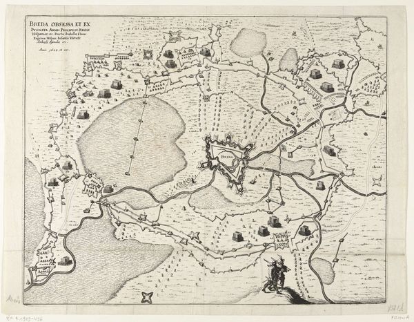
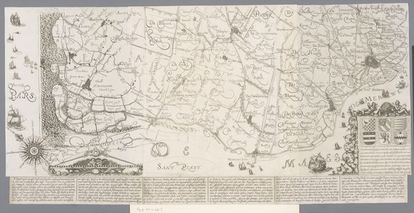
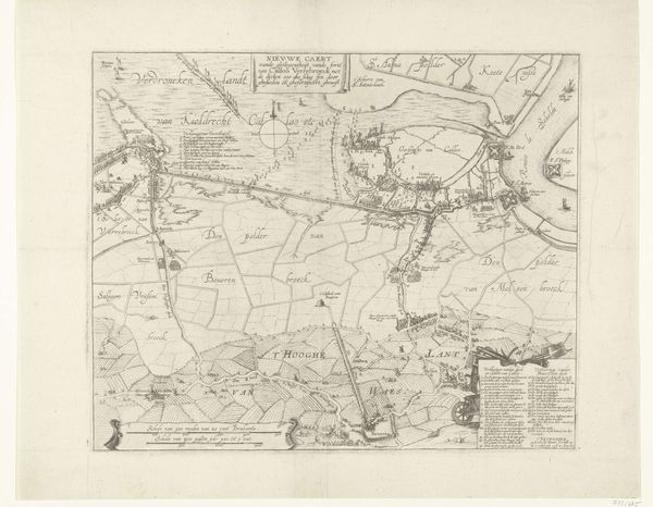
This is an anonymous map of the Barony of Breda, made around the time of the siege of 1624-1625. The map offers more than geographical data; it's a window into the political and military strategies of the Dutch Golden Age. Maps like these served a crucial purpose. They guided military campaigns, demarcated territories, and projected power. The detailed depiction of Breda and its surroundings, with clear lines of sight and potential routes, suggests its use in planning and executing military operations. The Siege of Breda was a key moment in the Eighty Years' War, a struggle for Dutch independence from Spanish rule. What might look like an objective rendering of space is, in fact, a strategic tool, deeply embedded in the power dynamics of its time. To understand this map fully, one can consult military archives, period chronicles, and art historical studies that explore the intersection of cartography, warfare, and statecraft in the 17th century.
Comments
No comments
Be the first to comment and join the conversation on the ultimate creative platform.