About this artwork
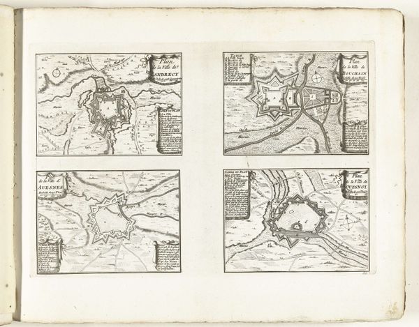
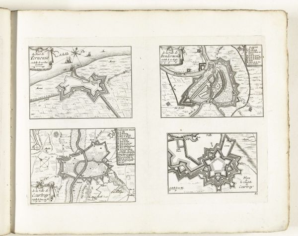
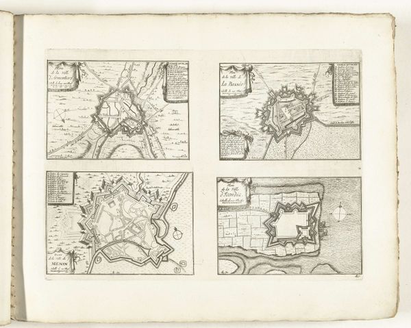
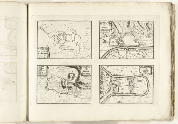
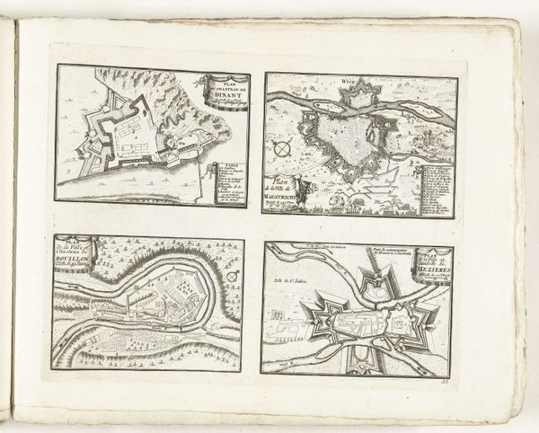
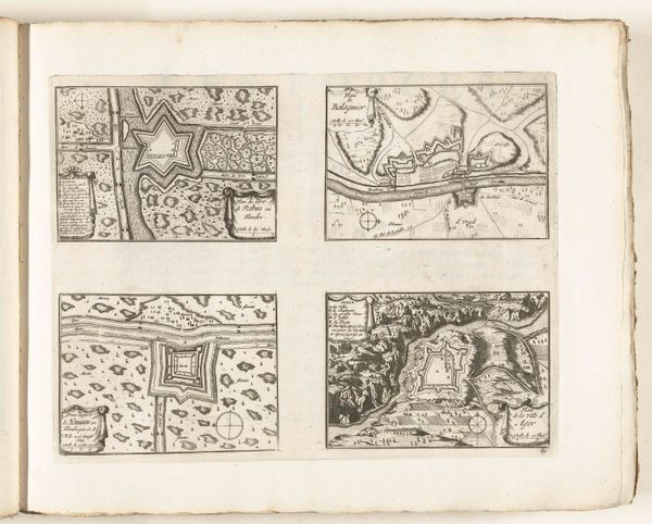
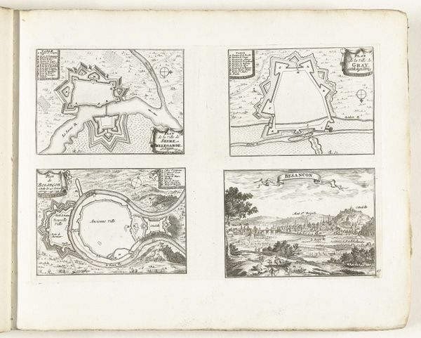
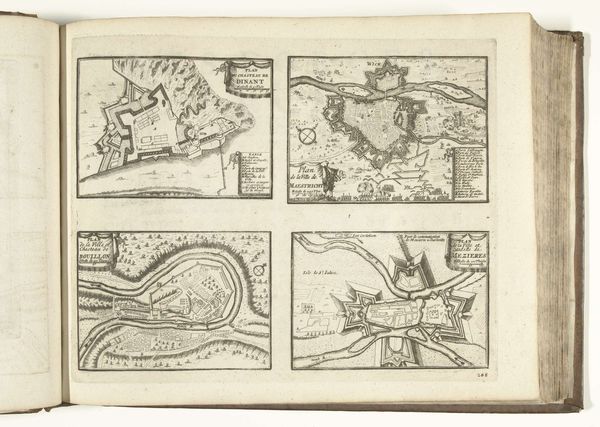
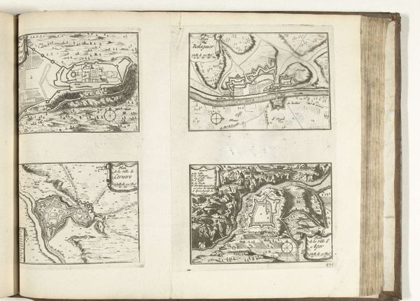
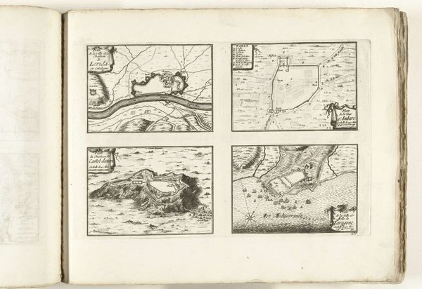
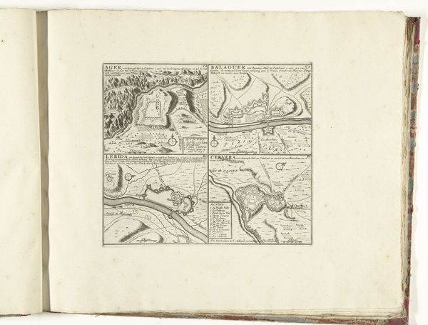
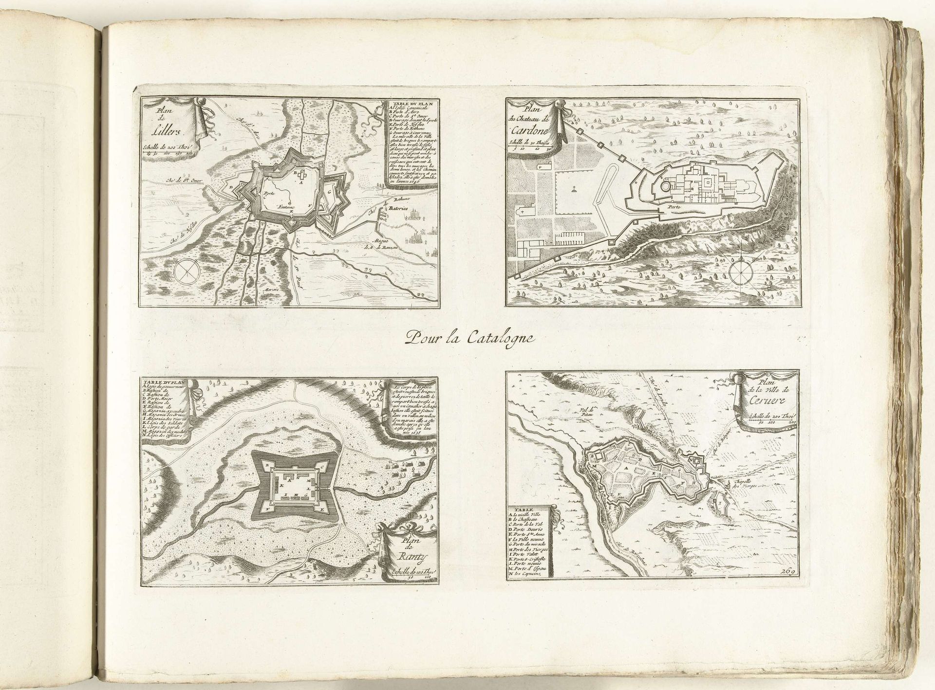
This print, made around 1702 by an anonymous artist, offers a bird's-eye view of several fortified locations in Catalonia and elsewhere. The image creates meaning through the stark contrast of black ink on white paper, emphasizing the geometric shapes of the fortifications against the natural landscape. This was a period of intense political and military conflict in Europe, notably the War of the Spanish Succession. Catalonia, with its strategic location, was a key territory fought over by European powers. These maps, then, weren't just geographical documents; they were tools of war, essential for military planning and control. The very act of mapping was an assertion of power, turning complex terrains into manageable, knowable spaces. To fully appreciate this work, one might delve into military archives, historical maps, and political documents of the period, uncovering the strategies and power dynamics that shaped not just these images, but the course of history. Ultimately, this print reminds us that art—even in the form of a seemingly objective map—is deeply embedded in social and institutional contexts.
Plattegronden van Cardona en andere plaatsen in Catalonië, ca. 1702
1702 - 1703
Anonymous
@anonymousLocation
RijksmuseumArtwork details
- Medium
- drawing, print, paper, ink, engraving
- Dimensions
- height 254 mm, width 339 mm
- Location
- Rijksmuseum
- Copyright
- Rijks Museum: Open Domain
Tags
Comments
Share your thoughts
About this artwork
This print, made around 1702 by an anonymous artist, offers a bird's-eye view of several fortified locations in Catalonia and elsewhere. The image creates meaning through the stark contrast of black ink on white paper, emphasizing the geometric shapes of the fortifications against the natural landscape. This was a period of intense political and military conflict in Europe, notably the War of the Spanish Succession. Catalonia, with its strategic location, was a key territory fought over by European powers. These maps, then, weren't just geographical documents; they were tools of war, essential for military planning and control. The very act of mapping was an assertion of power, turning complex terrains into manageable, knowable spaces. To fully appreciate this work, one might delve into military archives, historical maps, and political documents of the period, uncovering the strategies and power dynamics that shaped not just these images, but the course of history. Ultimately, this print reminds us that art—even in the form of a seemingly objective map—is deeply embedded in social and institutional contexts.
Comments
Share your thoughts