Plattegronden van Tortosa en andere plaatsen in Catalonië, ca. 1702 1702 - 1703
0:00
0:00
anonymous
Rijksmuseum
drawing, print, paper, ink, engraving
#
drawing
#
baroque
# print
#
paper
#
ink
#
geometric
#
cityscape
#
engraving
Dimensions: height 253 mm, width 360 mm
Copyright: Rijks Museum: Open Domain
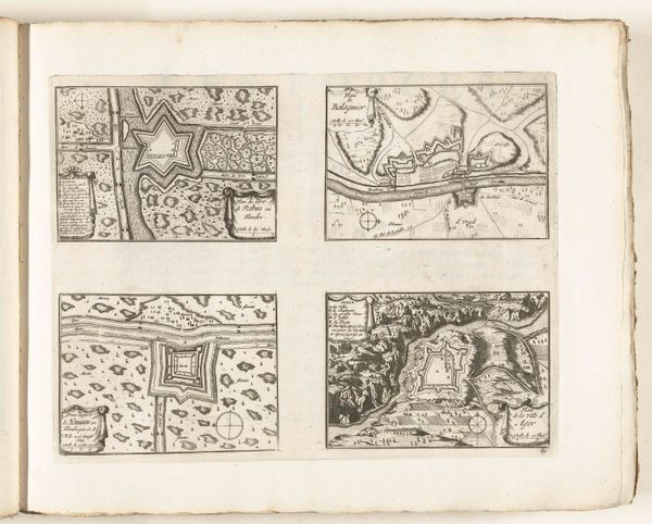
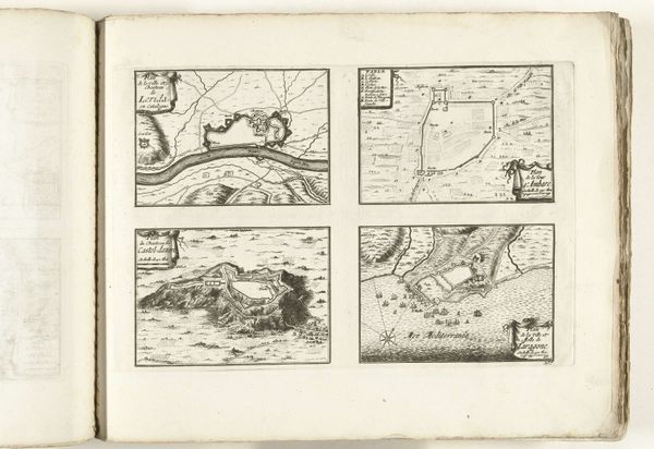
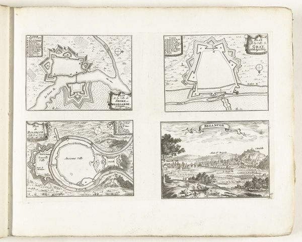
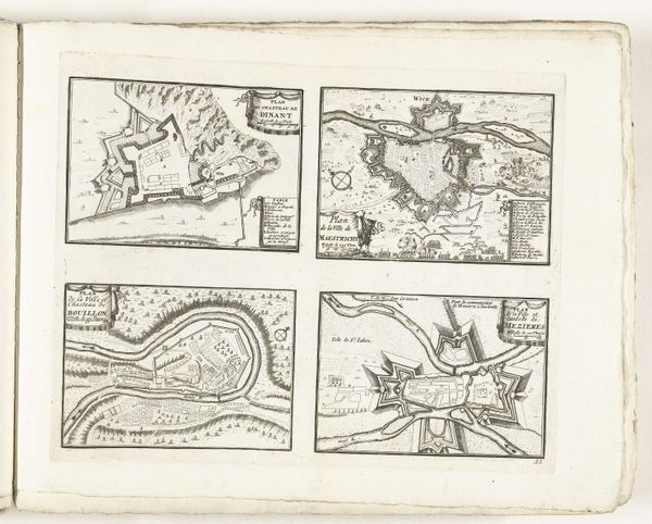
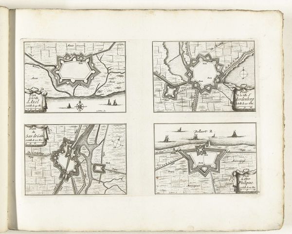
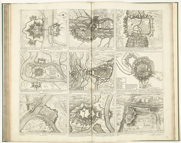
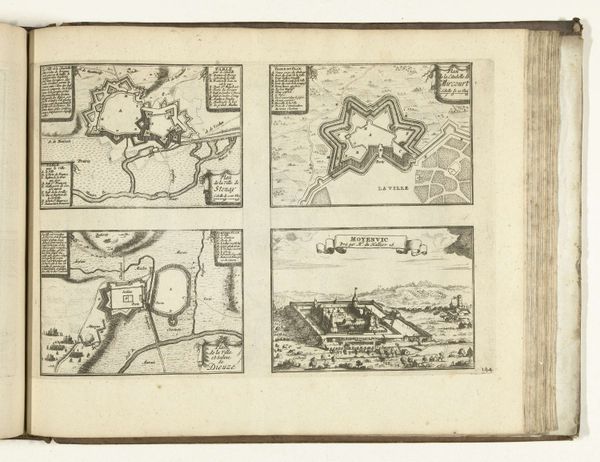
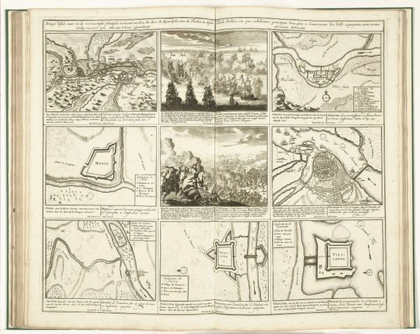
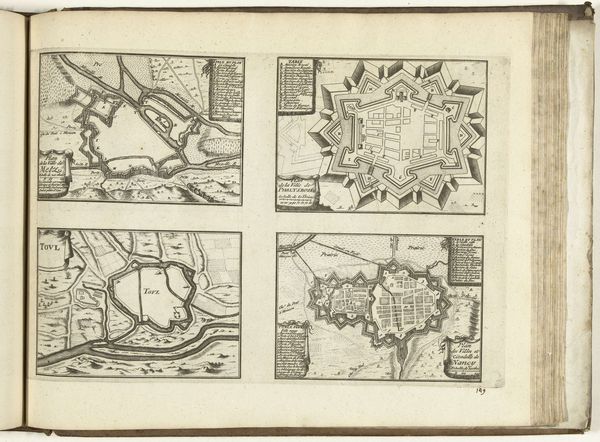
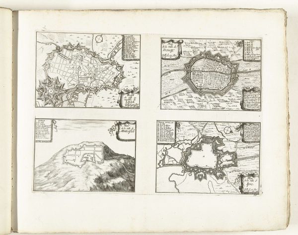
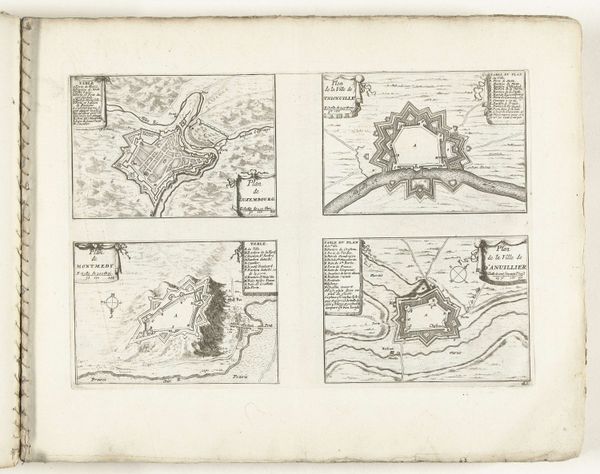
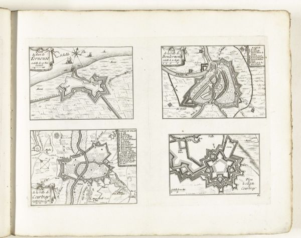
These maps of Tortosa and other Catalan locations were made around 1702 by an anonymous artist, using the technique of etching. Consider the material reality of this print: an image created through the careful application of acid to a metal plate, then transferred to paper through the immense pressure of a printing press. Each impression would have taken time and labor. The fineness of line suggests a highly skilled etcher. The maps’ original context is significant. They were not made for aesthetic contemplation, but for practical purposes –likely military strategy. By documenting terrain and fortifications, this etcher contributed to real-world conflicts. So, the maps become less about art and more about war, power, and territory. Thinking about the materials, making, and historical context encourages us to understand how aesthetics are always entangled with practical concerns, blurring the boundary between art and utility.
Comments
No comments
Be the first to comment and join the conversation on the ultimate creative platform.
More like this