About this artwork
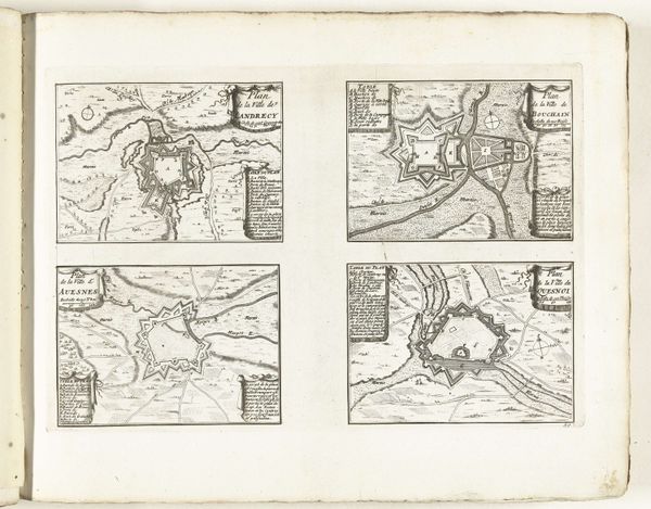
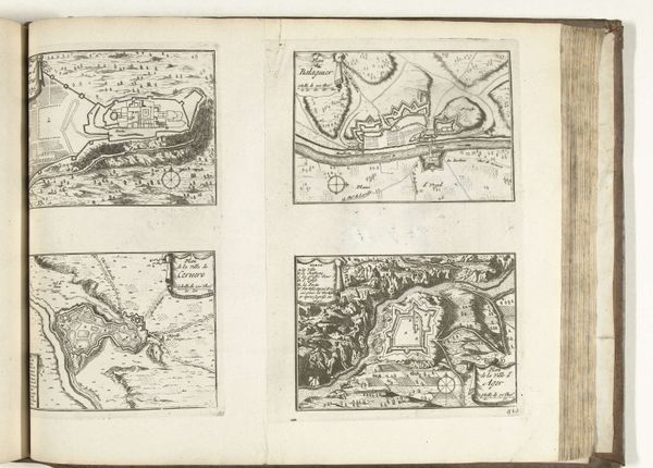
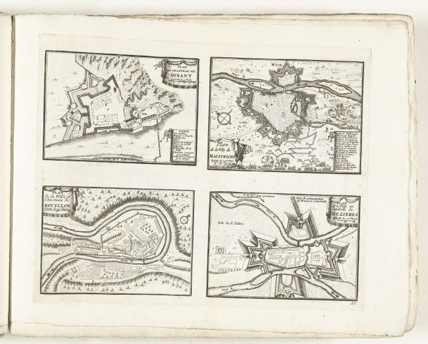
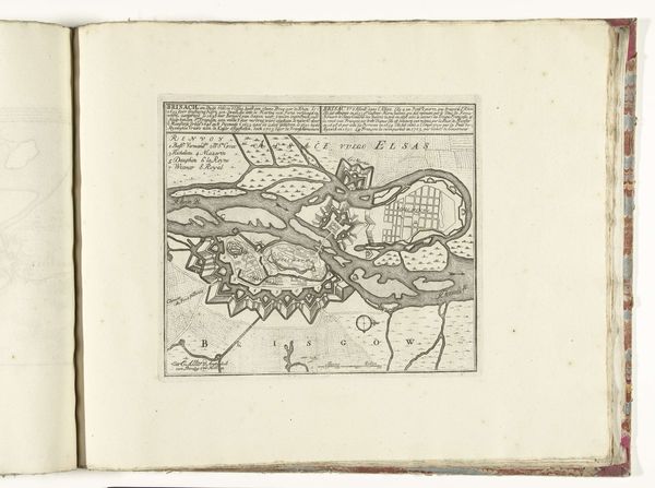
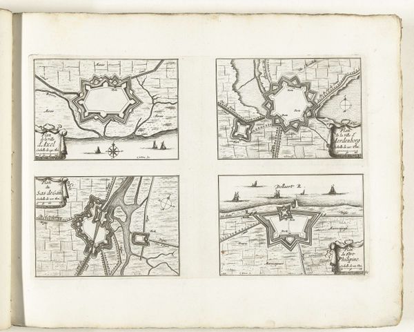
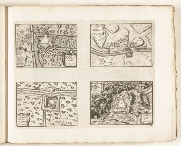
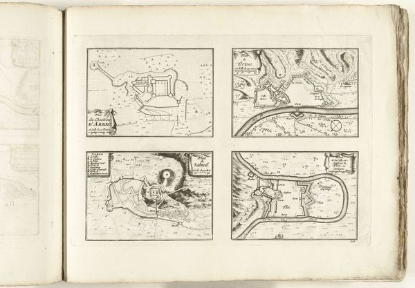
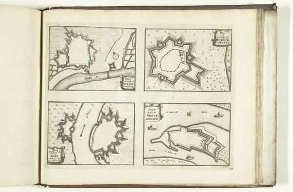
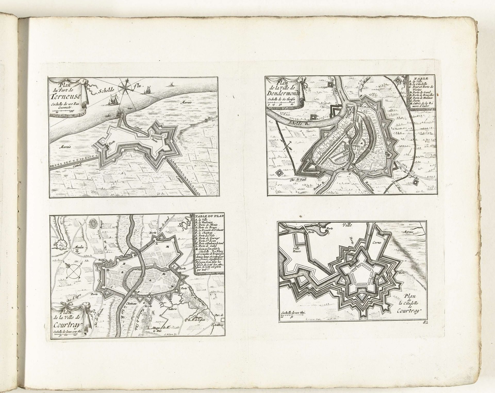
These plans of Terneuzen, Dendermonde, Kortrijk and the citadel of Kortrijk were drawn around 1702 by Laurens Scherm. Scherm died shortly after at only 31 years of age. The images reflect the fraught political landscape of the Low Countries during the War of the Spanish Succession. As sites of military and economic importance, the cities were strategic targets. The maps offer an insight into the 18th-century military mindset which prioritized control and defense of urban centers. These detailed fortifications also reflect a society deeply entrenched in conflict. Beyond the military and political dimensions, the maps evoke the lived experiences of the civilians. The emotional weight of living in a fortified city – the constant threat of siege, the restrictions on movement, and the ever-present military presence – shaped the daily lives of the inhabitants, and still speaks to us today.
Plattegronden van Terneuzen, Dendermonde, Kortrijk en de citadel van Kortrijk, ca. 1702
1702 - 1703
Laurens Scherm
1671 - 1702Location
RijksmuseumArtwork details
- Medium
- print, engraving, architecture
- Dimensions
- height 246 mm, width 353 mm
- Location
- Rijksmuseum
- Copyright
- Rijks Museum: Open Domain
Tags
Comments
Share your thoughts
About this artwork
These plans of Terneuzen, Dendermonde, Kortrijk and the citadel of Kortrijk were drawn around 1702 by Laurens Scherm. Scherm died shortly after at only 31 years of age. The images reflect the fraught political landscape of the Low Countries during the War of the Spanish Succession. As sites of military and economic importance, the cities were strategic targets. The maps offer an insight into the 18th-century military mindset which prioritized control and defense of urban centers. These detailed fortifications also reflect a society deeply entrenched in conflict. Beyond the military and political dimensions, the maps evoke the lived experiences of the civilians. The emotional weight of living in a fortified city – the constant threat of siege, the restrictions on movement, and the ever-present military presence – shaped the daily lives of the inhabitants, and still speaks to us today.
Comments
Share your thoughts