drawing, print, paper, ink
drawing
aged paper
toned paper
pen sketch
sketch book
landscape
paper
personal sketchbook
ink
geometric
pen-ink sketch
pen and pencil
pen work
sketchbook drawing
cityscape
sketchbook art
Dimensions: height 270 mm, width 338 mm
Copyright: Rijks Museum: Open Domain
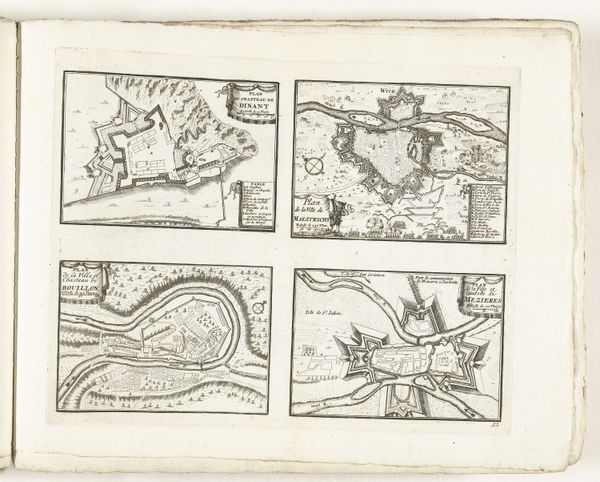
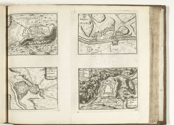
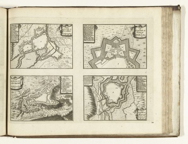
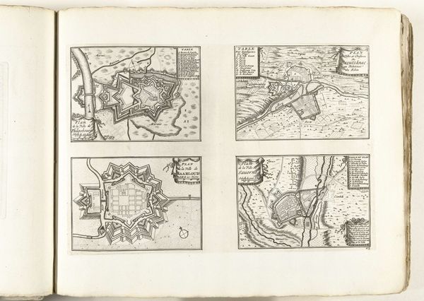
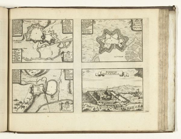
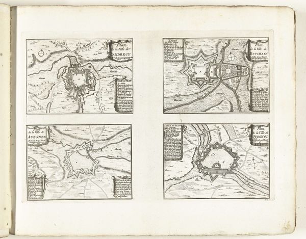
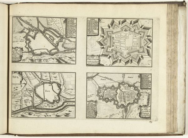
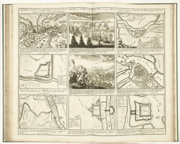
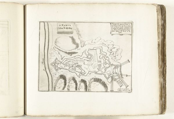
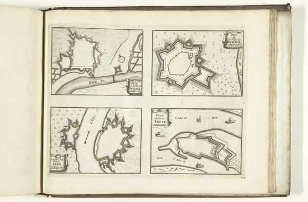
These plans of Dinant, Maastricht, Bouillon, and Mézières were printed in 1726, using a technique called engraving. The process begins with a metal plate, likely copper. The design is cut into the surface with sharp tools, and then ink is applied, settling into the carved lines. Paper is pressed against the plate, transferring the ink and creating the print. You can see the incredible detail achieved through this method – all those tiny lines describing the architecture and landscape! Engraving demanded precision and skill, a real mastery of the material. But it was also a process that allowed for relatively easy reproduction, distributing information widely. In this case, strategic details about fortresses. Consider the labor involved – the careful cutting, the inking, the pressing. It's a reminder that even seemingly simple images have a deep history of making and a close connection to political and social power. Recognizing this changes how we value this, and other works of applied art.
Comments
No comments
Be the first to comment and join the conversation on the ultimate creative platform.