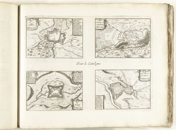
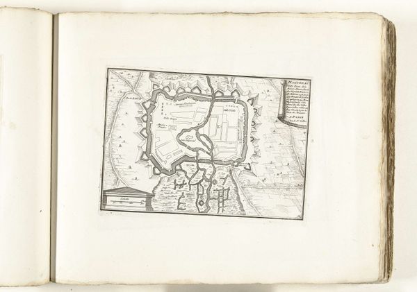
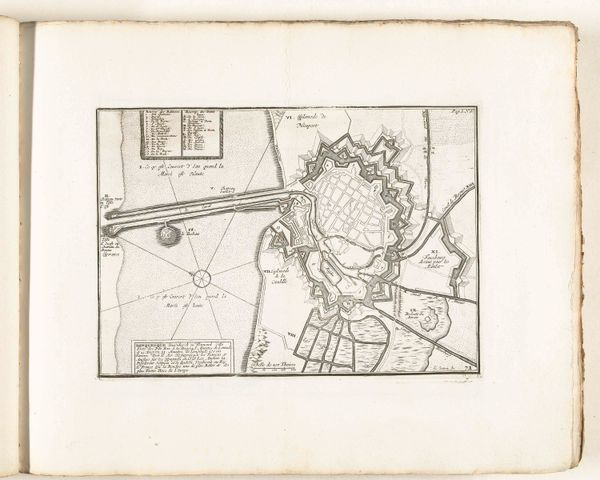
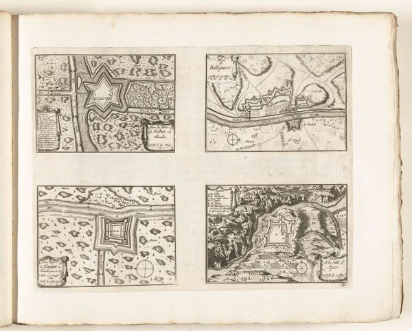
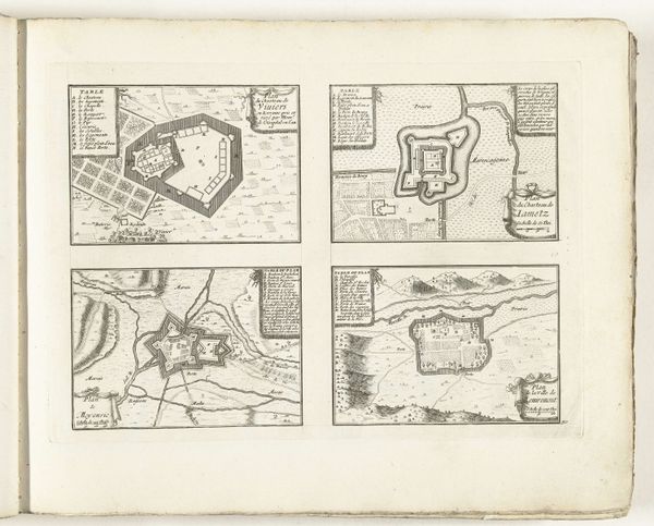
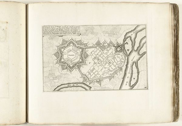
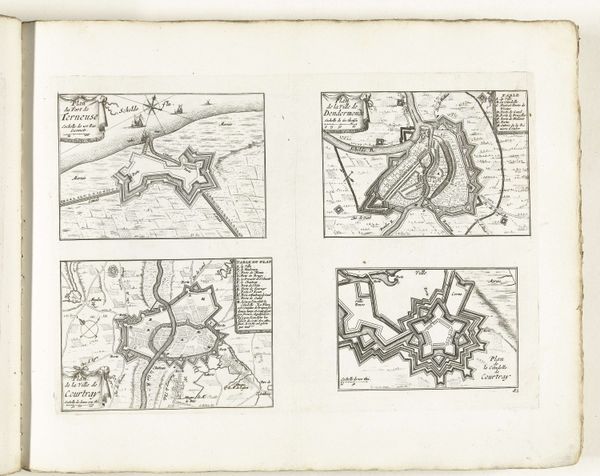
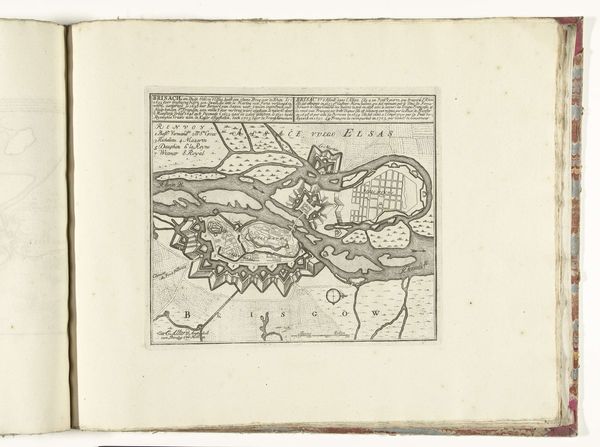
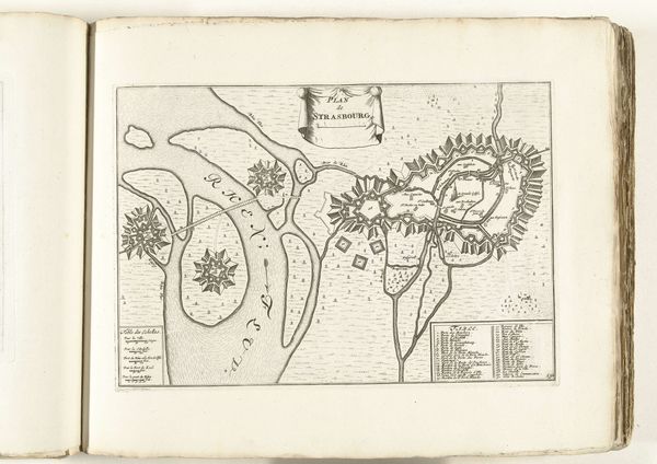
Plattegronden van Armentieres, La Bassée, Menin en IJzendijke, ca. 1702 1702 - 1703
0:00
0:00
laurensscherm
Rijksmuseum
drawing, print, paper, ink, engraving
#
drawing
#
baroque
# print
#
perspective
#
paper
#
ink
#
cityscape
#
engraving
Dimensions: height 247 mm, width 339 mm
Copyright: Rijks Museum: Open Domain
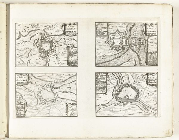
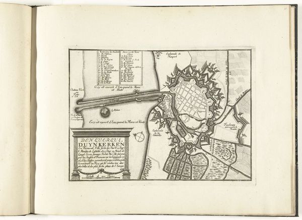
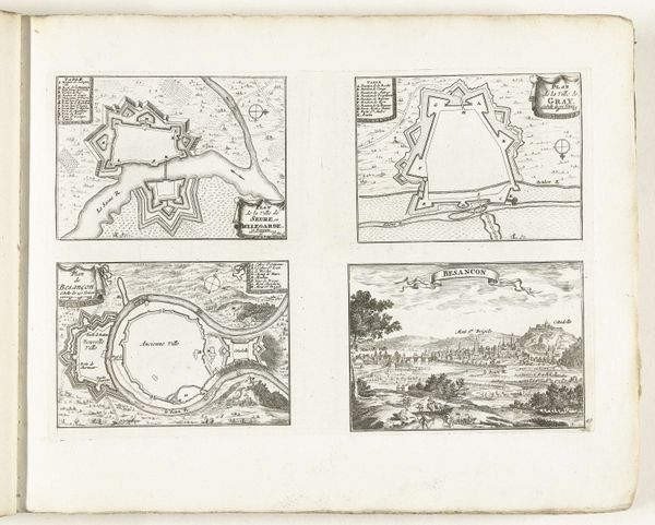
These four maps of fortified towns were etched in the Netherlands around 1702 by Laurens Scherm, a military engineer and draughtsman. The etching technique used to produce this print involves coating a metal plate with a waxy, acid-resistant substance called ground, and then drawing the image onto the ground with a sharp needle. The plate is then immersed in acid, which bites into the metal where the ground has been removed, creating recessed lines. These lines are then filled with ink and the plate is pressed onto paper. Here, the etcher has skillfully delineated the complex geometries of the fortifications, using the graphic language of lines and hatching to describe not just the shapes of the towns, but also the textures of the land. Although seemingly a world apart from craft traditions, this kind of etching required high levels of technical skill. The degree of detail suggests a painstaking and time-consuming process. Next time you look at a print, consider the labor, skill, and materials that went into its making. Processes can be revealing, shifting our perspective on the social and cultural meanings of art.
Comments
No comments
Be the first to comment and join the conversation on the ultimate creative platform.
More like this