Dimensions: height 499 mm, width 578 mm
Copyright: Rijks Museum: Open Domain
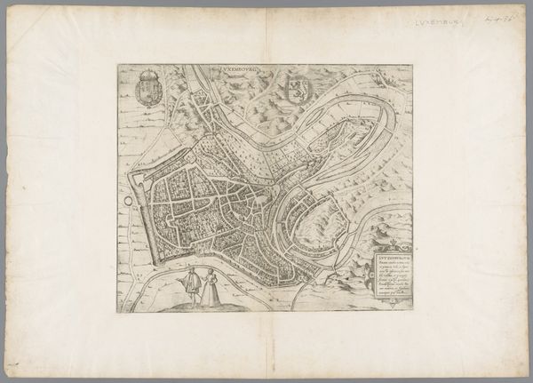
Matthaeus Seutter created this engraving of Luxembourg, a bird's eye view and map, likely in the early 18th century. This beautifully rendered piece is more than just a geographical document, it's a political statement about power and control. Look closely and you'll notice that the city is meticulously planned, every street and building laid out with geometrical precision, surrounded by impressive fortifications. In its time, cartography was an art of sovereign power, and maps helped define territories for administrative and military purposes. Seutter, based in Augsburg, Germany, was renowned for his detailed and decorative maps. His work reflects the ambitions of European powers vying for dominance. Luxembourg, with its strategic location, was a coveted prize, its control constantly shifting between empires. Historians consult archives, military records, and period documents to decode the political and social meanings embedded in maps like these. By understanding the context in which it was made, we can start to grasp the complex interplay of power, knowledge, and representation in this image of Luxembourg.
Comments
No comments
Be the first to comment and join the conversation on the ultimate creative platform.
More like this